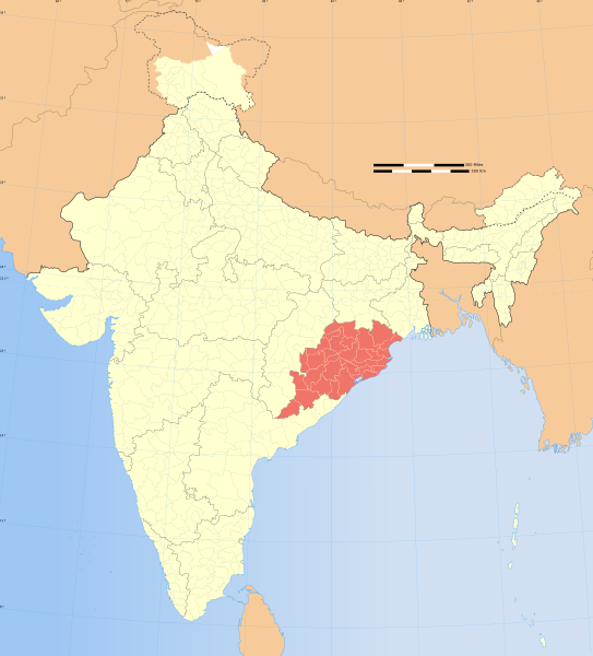
File:India Orissa locator map.svg

此 SVG 檔案的 PNG 預覽的大小:543 × 600 像素。 其他解析度:217 × 240 像素 | 435 × 480 像素 | 695 × 768 像素 | 927 × 1,024 像素 | 1,855 × 2,048 像素 | 1,574 × 1,738 像素。
原始檔案 (SVG 檔案,表面大小:1,574 × 1,738 像素,檔案大小:836 KB)
檔案歷史
點選日期/時間以檢視該時間的檔案版本。
| 日期/時間 | 縮圖 | 尺寸 | 用戶 | 備註 | |
|---|---|---|---|---|---|
| 目前 | 2008年12月29日 (一) 07:09 |  | 1,574 × 1,738(836 KB) | Planemad | {{Information |Description= |Source= |Date= |Author= |Permission= |other_versions= }} |
| 2006年8月6日 (日) 17:41 |  | 1,639 × 1,852(751 KB) | Planemad | {{WikiProject_India_Maps |Title=Orissa locator map |Description=Locator map of the state of Orissa, India with district boundaries. |Source=. |Date=August 6 2006 |Author=w:user:Nichalpw:user:Planemad |Thumbdir=CHANGE }} |
檔案用途
全域檔案使用狀況
以下其他 wiki 使用了這個檔案:
- as.wikipedia.org 的使用狀況
- ba.wikipedia.org 的使用狀況
- be.wikipedia.org 的使用狀況
- bg.wikipedia.org 的使用狀況
- bn.wikipedia.org 的使用狀況
- br.wikipedia.org 的使用狀況
- cdo.wikipedia.org 的使用狀況
- ceb.wikipedia.org 的使用狀況
- da.wikipedia.org 的使用狀況
- en.wikipedia.org 的使用狀況
- Kadampara
- Utkal Plains
- Fulta
- Jagatpur, India
- Konark Beach
- Bamra State
- Template:Odisha-geo-stub
- Baisipalli Wildlife Sanctuary
- Panikoili
- Hirakud
- Balagoda
- Balimela
- Balugaon
- Bangura, India
- Belagachhia
- Byasanagar
- Chandapur
- Chandili
- Charbatia
- Dadhapatna
- Daitari
- Deracolliery Township
- Dungamal
- Fertilizer Corporation of India Township
- G. Udayagiri
- Ghantapada
- Hatibandha
- Jhumpura
- Kantilo
- Kashinagara
- Khaliapali
- Khariar Road
- Khatiguda
- Kotpad
- Lapanga
- Lattikata
- Makundapur
- Nuapatna
- OCL Industrial Township
- Panposh
- Pratapsasan
檢視此檔案的更多全域使用狀況。


