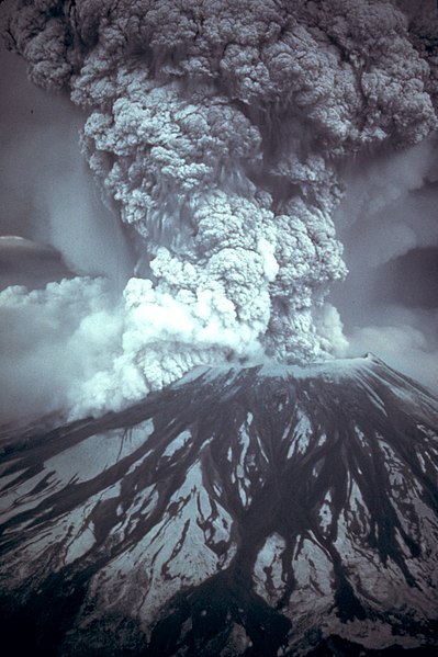
File:MSH80 eruption mount st helens 05-18-80.jpg

預覽大小:399 × 600 像素。 其他解析度:160 × 240 像素 | 319 × 480 像素 | 511 × 768 像素 | 681 × 1,024 像素 | 1,362 × 2,048 像素 | 2,994 × 4,500 像素。
原始檔案 (2,994 × 4,500 像素,檔案大小:1.43 MB,MIME 類型:image/jpeg)
檔案歷史
點選日期/時間以檢視該時間的檔案版本。
| 日期/時間 | 縮圖 | 尺寸 | 用戶 | 備註 | |
|---|---|---|---|---|---|
| 目前 | 2007年11月28日 (三) 11:30 |  | 2,994 × 4,500(1.43 MB) | CarolSpears | {{Information |Description={{en|On May 18, 1980, at 8:32 a.m. Pacific Daylight Time, a magnitude 5.1 earthquake shook Mount St. Helens. The bulge and surrounding area slid away in a gigantic rockslide and debris avalanche, releasing pressure, and triggeri |
檔案用途
下列4個頁面有用到此檔案:
全域檔案使用狀況
以下其他 wiki 使用了這個檔案:
- af.wikipedia.org 的使用狀況
- ang.wikipedia.org 的使用狀況
- ar.wikipedia.org 的使用狀況
- ast.wikipedia.org 的使用狀況
- az.wikipedia.org 的使用狀況
- ca.wikipedia.org 的使用狀況
- co.wikipedia.org 的使用狀況
- cs.wikipedia.org 的使用狀況
- da.wikipedia.org 的使用狀況
- de.wikipedia.org 的使用狀況
- el.wikipedia.org 的使用狀況
- en.wikipedia.org 的使用狀況
- Mount St. Helens
- Wikipedia:Selected anniversaries/May 18
- Wikipedia:Recent additions 9
- Wikipedia:Today's featured article/September 2004
- Wikipedia:Today's featured article/September 13, 2004
- 1980 United States Senate elections
- History of Washington (state)
- Prediction of volcanic activity
- 1980 in the United States
- User:Asenine/FePi/Feb07
- Portal:United States/Anniversaries/May
- Portal:United States/Anniversaries/All
- Geology of the Pacific Northwest
- Portal:United States/Anniversaries/May/May 18
- Reid Blackburn
- Portal:Oregon/Selected article
- User:Anynobody/eruption
- Portal:Oregon/Selected article/22
- Wikipedia:Recent additions/2004/May
- Talk:Mount St. Helens/Archive 2
檢視此檔案的更多全域使用狀況。


