File:Map of Russia - North Caucasian Federal District.svg

此 SVG 檔案的 PNG 預覽的大小:800 × 462 像素。 其他解析度:320 × 185 像素 | 640 × 369 像素 | 1,024 × 591 像素 | 1,280 × 738 像素 | 2,560 × 1,477 像素 | 1,092 × 630 像素。
原始檔案 (SVG 檔案,表面大小:1,092 × 630 像素,檔案大小:95 KB)

|
The boundaries on this map show the de facto situation. This is just one of several different views on the subject (see COM:NPOV). |
| 描述 |
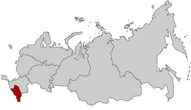
English: Map Russia highlighting the North Caucasian Federal districts.
Русский: Северо-Кавказский федеральный округ |
| 日期 | (UTC) |
| 來源 | Based on Map_of_Russian_subjects,_2008-03-01.svg |
| 作者 |
original: fremantleboy |
我,本作品的著作權持有者,決定用以下授權條款發佈本作品:
此檔案採用創用CC 姓名標示 2.5 通用版授權條款。
- 您可以自由:
- 分享 – 複製、發佈和傳播本作品
- 重新修改 – 創作演繹作品
- 惟需遵照下列條件:
- 姓名標示 – 您必須指名出正確的製作者,和提供授權條款的連結,以及表示是否有對內容上做出變更。您可以用任何合理的方式來行動,但不得以任何方式表明授權條款是對您許可或是由您所使用。
原始上傳日誌
This image is a derivative work of the following images:
- File:Map_of_Russian_subjects,_2008-03-01.svg licensed with Cc-by-2.5
- 2008-03-03T22:55:39Z Lokal Profil 1092x630 (296622 Bytes) Argh, updated using the wrong map. This is the 2008-03-01 map with federal district borders
- 2008-03-03T22:47:17Z Lokal Profil 1092x630 (295603 Bytes) Added thicker lines for Federal districts
- 2008-01-27T20:08:20Z Lokal Profil 1092x630 (227563 Bytes) Oupps... readded surrounding countries
- 2008-01-27T20:05:54Z Lokal Profil 1092x630 (191297 Bytes) Now also tagged by subject type
- 2008-01-26T23:00:44Z Lokal Profil 1092x630 (225978 Bytes) {{Information |Description=Map of Russia with merged subjects (01.03.2008, last merger [[w:en:Chita Oblast|Chita Oblast]]+[[w:en:Agin-Buryat Autonomous Okrug|Agin-Buryat Autonomous Okrug]] to form Zabaykalsky Krai.) The subje
Uploaded with derivativeFX
檔案歷史
點選日期/時間以檢視該時間的檔案版本。
| 日期/時間 | 縮圖 | 尺寸 | 用戶 | 備註 | |
|---|---|---|---|---|---|
| 目前 | 2015年3月10日 (二) 14:21 | | 1,092 × 630(95 KB) | Knyaz-1988 | Reverted to version as of 22:11, 3 November 2014 |
| 2014年11月4日 (二) 01:28 |  | 1,092 × 630(118 KB) | Fry1989 | NPOV issue. | |
| 2014年11月3日 (一) 22:11 |  | 1,092 × 630(95 KB) | Knyaz-1988 | New version | |
| 2010年1月21日 (四) 22:04 |  | 1,092 × 630(118 KB) | Denhud | {{Information |Description={{en|Map Russia highlighting the North Caucasian Federal districts.}} {{Ru|Северо-Кавказский федеральный округ}} |Source=Based on [[:File:Map_of_Russian_subject |
檔案用途
下列頁面有用到此檔案:
全域檔案使用狀況
以下其他 wiki 使用了這個檔案:
- ar.wikipedia.org 的使用狀況
- arz.wikipedia.org 的使用狀況
- azb.wikipedia.org 的使用狀況
- be-tarask.wikipedia.org 的使用狀況
- be.wikipedia.org 的使用狀況
- bg.wikipedia.org 的使用狀況
- ca.wikipedia.org 的使用狀況
- el.wikipedia.org 的使用狀況
- en.wikipedia.org 的使用狀況
- es.wikipedia.org 的使用狀況
- et.wikipedia.org 的使用狀況
- eu.wikipedia.org 的使用狀況
- fa.wikipedia.org 的使用狀況
- hu.wikipedia.org 的使用狀況
- ja.wikipedia.org 的使用狀況
- kk.wikipedia.org 的使用狀況
- ko.wikipedia.org 的使用狀況
- mk.wikipedia.org 的使用狀況
- mr.wikipedia.org 的使用狀況
- nl.wikipedia.org 的使用狀況
- pfl.wikipedia.org 的使用狀況
- pl.wikipedia.org 的使用狀況
- pl.wikivoyage.org 的使用狀況
- pt.wikipedia.org 的使用狀況
- ru.wikinews.org 的使用狀況
- sv.wikipedia.org 的使用狀況
- th.wikipedia.org 的使用狀況
- tl.wikipedia.org 的使用狀況
- tr.wikipedia.org 的使用狀況
- uk.wikipedia.org 的使用狀況
- vi.wikipedia.org 的使用狀況
- www.wikidata.org 的使用狀況
- zh-yue.wikipedia.org 的使用狀況