File:Ph map cavite.png

預覽大小:569 × 600 像素。 其他解析度:228 × 240 像素 | 612 × 645 像素。
原始檔案 (612 × 645 像素,檔案大小:76 KB,MIME 類型:image/png)
檔案歷史
點選日期/時間以檢視該時間的檔案版本。
| 日期/時間 | 縮圖 | 尺寸 | 用戶 | 備註 | |
|---|---|---|---|---|---|
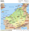
| 目前 | 2007年5月3日 (四) 14:19 |  | 612 × 645(76 KB) | Ppntori | {{Information |Description=Map of the province of en:Cavite, en:Philippines. It is a topographic map showing the municipalities and cities, major and minor roads, and notable places of interest. Created and copyright (2003) by [[:en:User:Seav|s |
檔案用途
下列頁面有用到此檔案:
全域檔案使用狀況
以下其他 wiki 使用了這個檔案:
- cbk-zam.wikipedia.org 的使用狀況
- de.wikipedia.org 的使用狀況
- en.wikipedia.org 的使用狀況
- hy.wikipedia.org 的使用狀況
- id.wikipedia.org 的使用狀況
- jv.wikipedia.org 的使用狀況
- ka.wikipedia.org 的使用狀況
- mk.wikipedia.org 的使用狀況
- ru.wikipedia.org 的使用狀況
- tl.wikipedia.org 的使用狀況
- vi.wikipedia.org 的使用狀況
- war.wikipedia.org 的使用狀況

