File:PresqueIsleStatePark.JPG

預覽大小:800 × 517 像素。 其他解析度:320 × 207 像素 | 640 × 413 像素 | 1,024 × 661 像素 | 1,280 × 827 像素 | 2,871 × 1,854 像素。
原始檔案 (2,871 × 1,854 像素,檔案大小:767 KB,MIME 類型:image/jpeg)
摘要
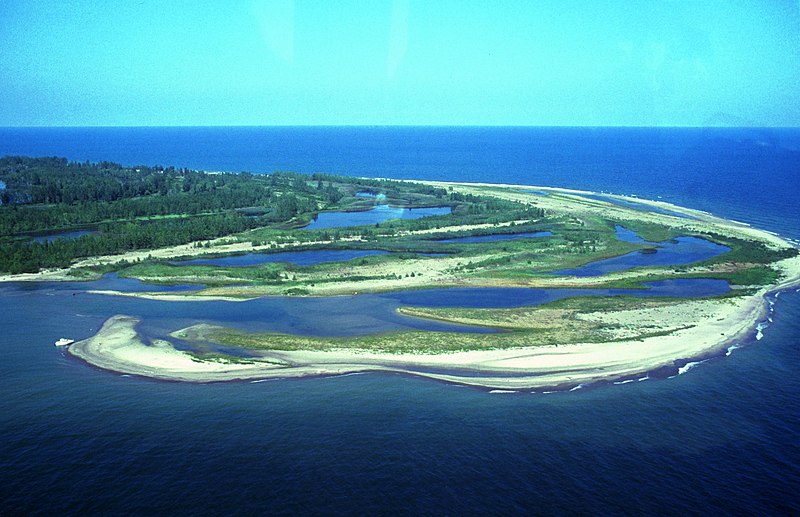
| 描述 | Aerial view of w:Presque Isle State Park, w:Erie, Pennsylvania. The photo is taken from the northeast and shows Gull Point in the foreground. Photo has some problems because of scanning. |
| 日期 | 日期不明 |
| 來源 | http://www.fhwa.dot.gov/byways/photos/59490 |
| 作者 | Robert K. Grubbs; cleaned up and color-corrected by Howcheng |
| 授權許可 (重用此檔案) |
Released to public domain when submitted to the FHWA with 2005 nomination application. |
| 其他版本 | Original sample available at source URL. |
| 拍攝地點 | | 位於此地的本圖片與其他圖片: OpenStreetMap |
|---|
授權條款
| 此作品已由其作者,Robert K. Grubbs,釋出至公有領域。此授權條款在全世界均適用。 這可能在某些國家不合法,如果是的話: Robert K. Grubbs授予任何人有權利使用此作品於任何用途,除受法律約束外,不受任何限制。
|
檔案歷史
點選日期/時間以檢視該時間的檔案版本。
| 日期/時間 | 縮圖 | 尺寸 | 用戶 | 備註 | |
|---|---|---|---|---|---|
| 目前 | 2006年4月21日 (五) 17:47 | | 2,871 × 1,854(767 KB) | Holly Cheng | ==Summary== {{Information | Description=Aerial view of w:Presque Isle State Park, w:Erie, Pennsylvania. The photo is taken from the northeast and shows Gull Point in the foreground. Photo has some problems because of scanning. | Source=http://libr |
檔案用途
下列頁面有用到此檔案:
全域檔案使用狀況
以下其他 wiki 使用了這個檔案:
- ca.wikipedia.org 的使用狀況
- en.wikipedia.org 的使用狀況
- Lake Erie
- List of Pennsylvania state parks
- Presque Isle State Park
- User talk:Pnoble805
- User talk:Tomdonohue1
- User talk:Trey/archive A
- User:SandyGeorgia/Barnstars
- User talk:Niagara/Archive 2
- User:Trey/Barnstars
- User talk:VerruckteDan/Archive6
- User talk:TomStar81/Archive 4
- User talk:SandyGeorgia/arch23
- User:Gerry D/archive6
- User talk:Michael Devore/Archive 1
- User talk:Finetooth/Archive 1
- User talk:Dwarf Kirlston/FAC Archive
- User talk:YellowMonkey/Archive67
- Wikipedia:Today's featured article/November 2017
- Wikipedia:Today's featured article/November 18, 2017
- Wikipedia:Main Page history/2017 November 18
- fr.wikipedia.org 的使用狀況
- pl.wikipedia.org 的使用狀況
- qu.wikipedia.org 的使用狀況