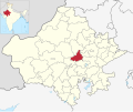
File:Ajmer in Rajasthan (India).svg

此 SVG 檔案的 PNG 預覽的大小:715 × 599 像素。 其他解析度:286 × 240 像素 | 573 × 480 像素 | 916 × 768 像素 | 1,222 × 1,024 像素 | 2,444 × 2,048 像素 | 1,093 × 916 像素。
原始檔案 (SVG 檔案,表面大小:1,093 × 916 像素,檔案大小:1.02 MB)
檔案歷史
點選日期/時間以檢視該時間的檔案版本。
| 日期/時間 | 縮圖 | 尺寸 | 用戶 | 備註 | |
|---|---|---|---|---|---|
| 目前 | 2023年9月28日 (四) 18:06 |  | 1,093 × 916(1.02 MB) | C1MM | updated bounds |
| 2023年2月27日 (一) 02:19 |  | 1,051 × 880(729 KB) | C1MM | updated bounds | |
| 2021年6月1日 (二) 16:30 |  | 1,059 × 887(932 KB) | C1MM | {{Information|Description=Map of Ajmer district of Rajasthan|Source=Derivative of File:India Rajasthan location map.svg|Date=1 June 2021|Author=Own work based on User:Milenioscuro|Permission={{Cc-by-sa-3.0}}}} Category:SVG locator maps of districts of Rajasthan |
檔案用途
下列頁面有用到此檔案:
全域檔案使用狀況
以下其他 wiki 使用了這個檔案:
- ar.wikipedia.org 的使用狀況
- arz.wikipedia.org 的使用狀況
- bn.wikipedia.org 的使用狀況
- ca.wikipedia.org 的使用狀況
- da.wikipedia.org 的使用狀況
- de.wikipedia.org 的使用狀況
- en.wikipedia.org 的使用狀況
- List of districts of Rajasthan
- Ajmer district
- User:Ts12rAc/sandbox
- Bubani, Ajmer
- Chachiyawas, Ajmer
- Akhri Village, Ajmer
- Template:AjmerDistrict-geo-stub
- Ajmer tehsil
- Badlya, Ajmer
- Boraj-Kazipura, Ajmer
- Amba Maseena, Ajmer
- Aradka, Ajmer
- Babayacha, Ajmer
- Badiya Ka Bala, Ajmer
- Baghpura, Ajmer
- Balwanta, Ajmer
- Banseli, Ajmer
- Bargaon, Ajmer
- Beer, Ajmer
- Bhanwta, Ajmer
- Bhawani Khera, Ajmer
- Bhoodol, Ajmer
- Chandiyawas, Ajmer
- Chawandiya, Ajmer
- Danta, Ajmer
- Bhinai
- Conquest of Ajmer
- es.wikipedia.org 的使用狀況
- eu.wikipedia.org 的使用狀況
- fa.wikipedia.org 的使用狀況
- fr.wikipedia.org 的使用狀況
- ha.wikipedia.org 的使用狀況
- incubator.wikimedia.org 的使用狀況
- it.wikipedia.org 的使用狀況
- ja.wikipedia.org 的使用狀況
- mai.wikipedia.org 的使用狀況
- ml.wikipedia.org 的使用狀況
- mr.wikipedia.org 的使用狀況
- nl.wikipedia.org 的使用狀況
- no.wikipedia.org 的使用狀況
- pnb.wikipedia.org 的使用狀況
- ru.wikipedia.org 的使用狀況
- sa.wikipedia.org 的使用狀況
檢視此檔案的更多全域使用狀況。
