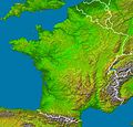
File:France radar 2.jpg

預覽大小:628 × 600 像素。 其他解析度:251 × 240 像素 | 503 × 480 像素 | 804 × 768 像素 | 1,072 × 1,024 像素 | 2,172 × 2,074 像素。
原始檔案 (2,172 × 2,074 像素,檔案大小:3.13 MB,MIME 類型:image/jpeg)
檔案歷史
點選日期/時間以檢視該時間的檔案版本。
| 日期/時間 | 縮圖 | 尺寸 | 用戶 | 備註 | |
|---|---|---|---|---|---|
| 目前 | 2006年2月23日 (四) 04:23 |  | 2,172 × 2,074(3.13 MB) | Sting | '''en :''' * '''Subject :''' France viewed by NASA Shuttle radar-imaging ; * '''Source :''' [http://earthobservatory.nasa.gov/Newsroom/NewImages/images.php3?img_id=15360 NASA Earth Observatory] (modified) ; * '''Original image in Wikipedia :''' [[:Image: |
檔案用途
下列頁面有用到此檔案:
全域檔案使用狀況
以下其他 wiki 使用了這個檔案:
- de.wikipedia.org 的使用狀況
- de.wikinews.org 的使用狀況
- en.wikipedia.org 的使用狀況
- eo.wikipedia.org 的使用狀況
- es.wikipedia.org 的使用狀況
- frp.wikipedia.org 的使用狀況
- fr.wikipedia.org 的使用狀況
- Région naturelle de France
- Discussion:Région naturelle de France
- Utilisateur:Bludwarf
- Utilisateur:Chauki
- Utilisateur:Wikisoft*/Frageoloc
- Utilisateur:Wikisoft*/Paris
- Utilisateur:Wikisoft*/Cartes
- Utilisateur:Wikisoft*/Tests cartes 1
- Discussion utilisateur:Wikisoft*/Tests cartes 1
- Discussion utilisateur:TomKr/Cartographie
- Utilisateur:Wikisoft*/Géobox-Montagnes-France
- Garrigues (région naturelle)
- is.wikipedia.org 的使用狀況
- wuu.wikipedia.org 的使用狀況


