File:Kilauea - Landsat mosaic.jpg

預覽大小:800 × 592 像素。 其他解析度:320 × 237 像素 | 640 × 474 像素 | 1,024 × 758 像素 | 1,280 × 948 像素 | 2,563 × 1,898 像素。
原始檔案 (2,563 × 1,898 像素,檔案大小:1.48 MB,MIME 類型:image/jpeg)
摘要
| 描述 |
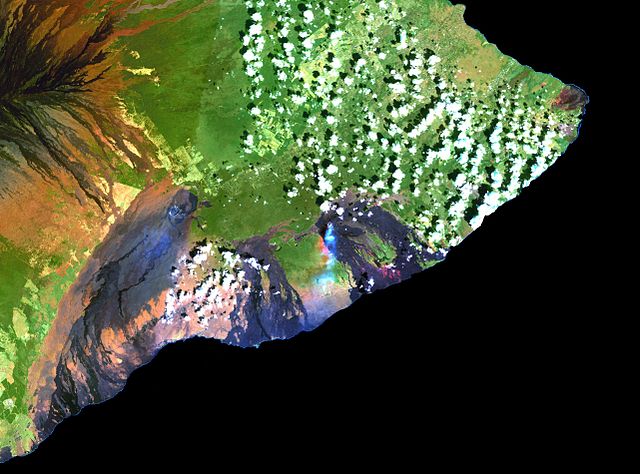
English: This simulated true-color image of the Kilauea was derived from data gathered by the Enhanced Thematic Mapper plus (ETM+) on the Landsat 7 satellite between 1999 and 2001. Français : Cette image en fausses couleurs du Kilauea est issue de données recueillies entre 1999 et 2001 par le capteur Enhanced Thematic Mapper plus (ETM+) situé sur le satellite Landsat 7. |
| 日期 | 在1999年到2001年之間 |
| 來源 | Cropped version of File:Island of Hawai'i - Landsat mosaic.jpg (Image and its description) |
| 作者 | Hawaii Land Cover Analysis project, NOAA Coastal Services Center |
| 其他版本 | Entire picture : File:Island of Hawai'i - Landsat mosaic.jpg |
授權條款
本圖像屬於公有領域,因該作品最初來自於美國國家海洋和大氣管理局職員的職務作品。
|
檔案歷史
點選日期/時間以檢視該時間的檔案版本。
| 日期/時間 | 縮圖 | 尺寸 | 用戶 | 備註 | |
|---|---|---|---|---|---|
| 目前 | 2012年3月9日 (五) 11:11 | | 2,563 × 1,898(1.48 MB) | Rémih |
檔案用途
下列頁面有用到此檔案:
全域檔案使用狀況
以下其他 wiki 使用了這個檔案:
- ar.wikipedia.org 的使用狀況
- ast.wikipedia.org 的使用狀況
- ca.wikipedia.org 的使用狀況
- en.wikipedia.org 的使用狀況
- en.wikivoyage.org 的使用狀況
- es.wikipedia.org 的使用狀況
- es.wikivoyage.org 的使用狀況
- fr.wikipedia.org 的使用狀況
- hu.wikipedia.org 的使用狀況
- hy.wikipedia.org 的使用狀況
- it.wikivoyage.org 的使用狀況
- ja.wikipedia.org 的使用狀況
- mk.wikipedia.org 的使用狀況
- ru.wikipedia.org 的使用狀況
- www.wikidata.org 的使用狀況