File:Rail Baltica Lietuva.jpg
預覽大小:800 × 600 像素。 其他解析度:320 × 240 像素 | 640 × 480 像素 | 1,024 × 768 像素 | 1,280 × 960 像素 | 2,592 × 1,944 像素。
原始檔案 (2,592 × 1,944 像素,檔案大小:1.17 MB,MIME 類型:image/jpeg)
摘要
| 描述 |
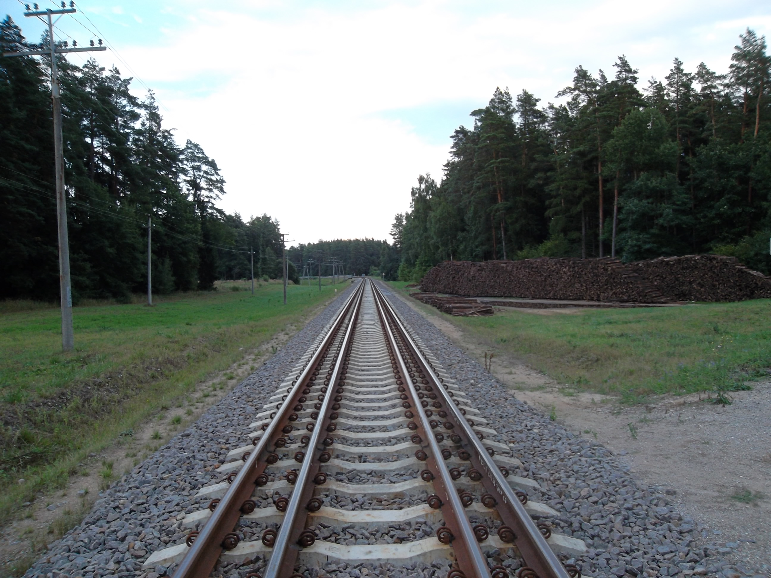
Lietuvių: Sudvejinta 1520 ir 1435 mm pločio vėžė "Rail baltica" geležinkelio atkarpoje Mockava – Šeštokai
|
| 日期 | 2013年十月11日 (原始上傳日期) |
| 來源 | lt.wiki |
| 作者 | 立陶宛文維基百科的Gediminas |
| 拍攝地點 | | 位於此地的本圖片與其他圖片: OpenStreetMap |
|---|
授權條款
Gediminas at the Lithuanian language Wikipedia,此作品的版權所有人,決定用以下授權條款發佈本作品:

|
已授權您依據自由軟體基金會發行的無固定段落、封面文字和封底文字GNU自由文件授權條款1.2版或任意後續版本,對本檔進行複製、傳播和/或修改。該協議的副本列在GNU自由文件授權條款中。 |
原始上傳日誌
Transferred from lt.wikipedia to Commons by Hugo.arg using CommonsHelper.
The original description page was here. All following user names refer to lt.wikipedia.
- 2013-10-11 21:52 Gediminas 2592×1944× (1223423 bytes) {{GFDL-self}}
檔案歷史
點選日期/時間以檢視該時間的檔案版本。
| 日期/時間 | 縮圖 | 尺寸 | 用戶 | 備註 | |
|---|---|---|---|---|---|
| 目前 | 2013年11月8日 (五) 12:42 | | 2,592 × 1,944(1.17 MB) | File Upload Bot (Magnus Manske) | Transfered from lt.wikipedia by User:Hugo.arg using CommonsHelper |
檔案用途
全域檔案使用狀況
以下其他 wiki 使用了這個檔案:
- de.wikipedia.org 的使用狀況
- en.wikipedia.org 的使用狀況
- hu.wikipedia.org 的使用狀況
- id.wikipedia.org 的使用狀況
- ja.wikipedia.org 的使用狀況
- lv.wikipedia.org 的使用狀況
- pl.wikipedia.org 的使用狀況
- pt.wikipedia.org 的使用狀況
- ru.wikipedia.org 的使用狀況
- sv.wikipedia.org 的使用狀況
- www.wikidata.org 的使用狀況