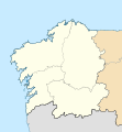
File:Spain Galicia location map.svg

此SVG文件的PNG预览的大小:512 × 553像素。 其他分辨率:222 × 240像素 | 444 × 480像素 | 711 × 768像素 | 948 × 1,024像素 | 1,896 × 2,048像素。
原始文件 (SVG文件,尺寸为512 × 553像素,文件大小:576 KB)
文件历史
点击某个日期/时间查看对应时刻的文件。
| 日期/时间 | 缩略图 | 大小 | 用户 | 备注 | |
|---|---|---|---|---|---|
| 当前 | 2016年10月19日 (三) 21:49 |  | 512 × 553(576 KB) | HombreDHojalata | [http://www.xunta.es/dog/Publicados/2013/20130607/AnuncioG0244-060613-0003_gl.html DECRETO 83/2013, do 6 de xuño, polo que se aproba a fusión voluntaria dos municipios de Oza dos Ríos e Cesuras e se constitúe o municipio de Oza-Cesuras] DOG, 7 de x... |
| 2016年10月19日 (三) 21:33 |  | 512 × 553(576 KB) | HombreDHojalata | [http://www.xunta.gal/dog/Publicados/2016/20161017/AnuncioG0244-131016-0001_gl.html DECRETO 134/2016, do 22 de setembro, polo que se aproba a fusión voluntaria dos municipios de Cerdedo e Cotobade e se constitúe o municipio de Cerdedo-Cotobade], DOG... | |
| 2010年5月20日 (四) 18:32 |  | 512 × 553(551 KB) | Miguillen | color mar | |
| 2010年5月20日 (四) 15:28 |  | 512 × 553(551 KB) | Miguillen | == {{int:filedesc}} == {{Information |Description={{en|Location map of Galicia (Spain)}} Equirectangular projection, N/S stretching 130 %. Geographic limits of the map: * N: 43.055249° N * S: 39.750129° N * W: 2.282836° O * E: 0. |
文件用途
全域文件用途
以下其他wiki使用此文件:
- ar.wikipedia.org上的用途
- ast.wikipedia.org上的用途
- az.wikipedia.org上的用途
- ba.wikipedia.org上的用途
- be.wikipedia.org上的用途
- bg.wikipedia.org上的用途
- ca.wikipedia.org上的用途
- ceb.wikipedia.org上的用途
- cs.wikipedia.org上的用途
- de.wikipedia.org上的用途
查看此文件的更多全域用途。
