File:Adelaide metropolitan area map.svg

此 SVG 檔案的 PNG 預覽的大小:246 × 599 像素。 其他解析度:98 × 240 像素 | 197 × 480 像素 | 315 × 768 像素 | 420 × 1,024 像素 | 840 × 2,048 像素 | 974 × 2,373 像素。
原始檔案 (SVG 檔案,表面大小:974 × 2,373 像素,檔案大小:298 KB)
摘要
| 描述 |
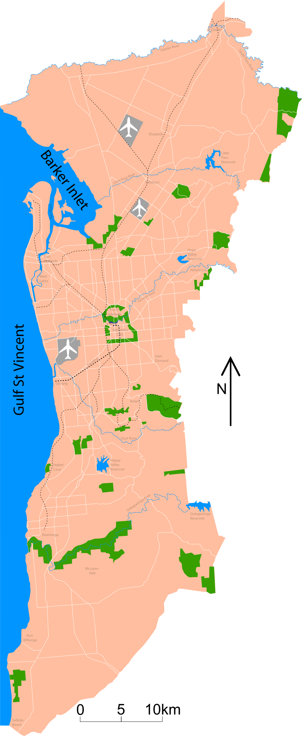
Map of Adelaide Shows major roads (per gregory's 2004 street directory), airports (adelaide, parafield and edinburgh airforce base) and all public reserves or parks > about 130 acres. Council district maps dated from 2004->2007 used to determine the landward boundary |
| 日期 | |
| 來源 | 自己的作品 |
| 作者 | Peripitus |
| SVG開發 |
授權條款
我,本作品的著作權持有者,決定用以下授權條款發佈本作品:

|
已授權您依據自由軟體基金會發行的無固定段落、封面文字和封底文字GNU自由文件授權條款1.2版或任意後續版本,對本檔進行複製、傳播和/或修改。該協議的副本列在GNU自由文件授權條款中。 |
您可以選擇您需要的授權條款。
檔案歷史
點選日期/時間以檢視該時間的檔案版本。
| 日期/時間 | 縮圖 | 尺寸 | 使用者 | 備註 | |
|---|---|---|---|---|---|
| 目前 | 2015年1月26日 (一) 10:53 | 974 × 2,373(298 KB) | Wereldburger758 | Valid SVG now. | |
| 2007年11月3日 (六) 02:45 | 974 × 2,373(331 KB) | Peripitus | {{Information |Description=Map of Adelaide Shows major roads (per gregory's 2004 street directory), airports (adelaide, parafield and edinburgh airforce base) and all public reserves or parks > about 130 acres. Council district maps dated from 2004->2007 | ||
| 2007年10月24日 (三) 09:13 | 974 × 2,373(136 KB) | Peripitus | {{Information |Description=Map of Adelaide Shows major roads (per gregory's 2004 street directory), airports (adelaide, parafield and edinburgh airforce base) and all public reserves or parks > about 130 acres. Council district maps dated from 2004->2007 | ||
| 2007年10月23日 (二) 21:32 | 487 × 1,188(144 KB) | Peripitus | {{Information |Description=Map of Adelaide Shows major roads (per gregory's 2004 street directory), airports (adelaide, parafield and edinburgh airforce base) and all public reserves or parks > about 130 acres. Council district maps dated from 2004->2007 | ||
| 2007年10月23日 (二) 13:38 | 487 × 1,188(145 KB) | Peripitus | {{Information |Description=Map of Adelaide Shows major roads (per gregory's 2004 street directory), airports (adelaide, parafield and edinburgh airforce base) and all public reserves or parks > about 130 acres. Council district maps dated from 2004->2007 | ||
| 2007年10月23日 (二) 13:35 |  | 749 × 1,188(145 KB) | Peripitus | Reverted to version as of 13:26, 23 October 2007 | |
| 2007年10月23日 (二) 13:34 | 487 × 1,188(166 KB) | Peripitus | {{Information |Description=Map of Adelaide Shows major roads (per gregory's 2004 street directory), airports (adelaide, parafield and edinburgh airforce base) and all public reserves or parks > about 130 acres. Council district maps dated from 2004->2007 | ||
| 2007年10月23日 (二) 13:26 |  | 749 × 1,188(145 KB) | Peripitus | {{Information |Description=Map of Adelaide Shows major roads (per gregory's 2004 street directory), airports (adelaide, parafield and edinburgh airforce base) and all public reserves or parks > about 130 acres. Council district maps dated from 2004->2007 |
檔案用途
沒有使用此檔案的頁面。
全域檔案使用狀況
以下其他 wiki 使用了這個檔案:
- af.wikipedia.org 的使用狀況
- ckb.wikipedia.org 的使用狀況
- el.wikipedia.org 的使用狀況
- en.wikipedia.org 的使用狀況
- es.wikipedia.org 的使用狀況
- hr.wikipedia.org 的使用狀況
- ka.wikipedia.org 的使用狀況
- ms.wikipedia.org 的使用狀況
- ru.wikipedia.org 的使用狀況