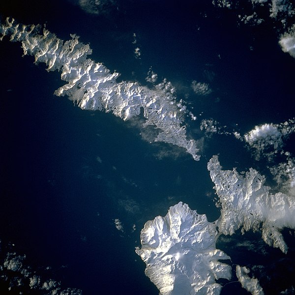
File:Aleutians-space.jpg

預覽大小:600 × 600 像素。 其他解析度:240 × 240 像素 | 480 × 480 像素 | 768 × 768 像素 | 1,024 × 1,024 像素 | 2,048 × 2,048 像素 | 3,904 × 3,904 像素。
原始檔案 (3,904 × 3,904 像素,檔案大小:10.69 MB,MIME 類型:image/jpeg)
檔案歷史
點選日期/時間以檢視該時間的檔案版本。
| 日期/時間 | 縮圖 | 尺寸 | 使用者 | 備註 | |
|---|---|---|---|---|---|
| 目前 | 2010年8月26日 (四) 14:43 |  | 3,904 × 3,904(10.69 MB) | Originalwana | higher res |
| 2004年12月4日 (六) 22:52 |  | 639 × 639(307 KB) | Mschlindwein | Aleutian Islands from space |
檔案用途
下列頁面有用到此檔案:
全域檔案使用狀況
以下其他 wiki 使用了這個檔案:
- en.wikipedia.org 的使用狀況
- es.wikipedia.org 的使用狀況
- gl.wikipedia.org 的使用狀況
- id.wikipedia.org 的使用狀況
- ms.wikipedia.org 的使用狀況
- nn.wikipedia.org 的使用狀況
- pl.wikipedia.org 的使用狀況
- pt.wikipedia.org 的使用狀況
- ru.wikipedia.org 的使用狀況
- sh.wikipedia.org 的使用狀況
- sr.wikipedia.org 的使用狀況
- ta.wikipedia.org 的使用狀況
- uk.wikipedia.org 的使用狀況
- vi.wikipedia.org 的使用狀況


