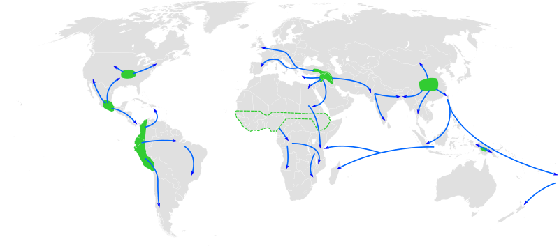
File:Centres of origin and spread of agriculture.svg

此 SVG 檔案的 PNG 預覽的大小:800 × 353 像素。 其他解析度:320 × 141 像素 | 640 × 283 像素 | 1,024 × 452 像素 | 1,280 × 565 像素 | 2,560 × 1,130 像素 | 940 × 415 像素。
原始檔案 (SVG 檔案,表面大小:940 × 415 像素,檔案大小:1.62 MB)
檔案歷史
點選日期/時間以檢視該時間的檔案版本。
| 日期/時間 | 縮圖 | 尺寸 | 使用者 | 備註 | |
|---|---|---|---|---|---|
| 目前 | 2013年5月23日 (四) 12:25 |  | 940 × 415(1.62 MB) | Cmglee | Make arrows blue to distinguish arrows and regions. |
| 2010年11月29日 (一) 12:35 |  | 940 × 415(1.67 MB) | Joey Roe | {{Information |Description={{en|1=Map of the world showing approximate centres of agriculture and its spread in prehistory: eastern USA (4000-3000 BP), Central Mexico (5000-4000 BP), Northern South America (5000-4000 BP), sub-Saharan Africa (5000-4000 BP, |
檔案用途
下列3個頁面有用到此檔案:
全域檔案使用狀況
以下其他 wiki 使用了這個檔案:
- af.wikipedia.org 的使用狀況
- ar.wikipedia.org 的使用狀況
- ast.wikipedia.org 的使用狀況
- as.wikipedia.org 的使用狀況
- az.wikipedia.org 的使用狀況
- bn.wikipedia.org 的使用狀況
- ca.wikipedia.org 的使用狀況
- de.wikipedia.org 的使用狀況
- dga.wikipedia.org 的使用狀況
- en.wikipedia.org 的使用狀況
- en.wikiquote.org 的使用狀況
- es.wikipedia.org 的使用狀況
- es.wikibooks.org 的使用狀況
- eu.wikipedia.org 的使用狀況
- fa.wikipedia.org 的使用狀況
- fi.wikipedia.org 的使用狀況
- fr.wikipedia.org 的使用狀況
檢視此檔案的更多全域使用狀況。

