File:PortlandBillAndChesilBeach(Landsat).jpg

預覽大小:618 × 600 像素。 其他解析度:247 × 240 像素 | 495 × 480 像素 | 940 × 912 像素。
原始檔案 (940 × 912 像素,檔案大小:372 KB,MIME 類型:image/jpeg)
.jpg?uselang=zh-tw)
.jpg?uselang=zh-tw)
.jpg?action=history&uselang=zh-tw)
.jpg)
| 描述 |
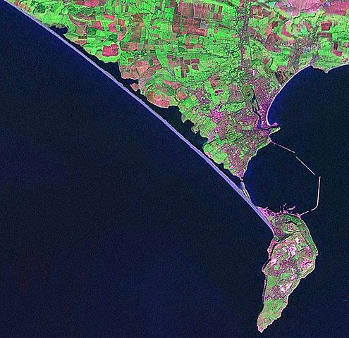
English: Screenshot from World Wind software displaying NASA Landsat imagery. The website says "The Landsat Global Mosaic, Blue Marble, and the USGS raster maps and images are all Public Domain." (http://www.worldwindcentral.com/wiki/World_Wind_FAQ) |
| 來源 | Satellite imagery taken from NASA World Wind software (by screenshot) |
| 作者 | 相片: NASA |
授權條款
| 本圖像屬於公有領域,因其為NASA的World Wind衛星地圖瀏覽器的一張截圖,且使用了公有領域圖層,如Blue Marble、MODIS、Landsat、SRTM、USGS、GLOBE等。
|
 |
原始上傳日誌
The original description page was here. All following user names refer to en.wikipedia.
- 2006-04-21 07:42 Euchiasmus 940×912× (381170 bytes) Screenshot from World Wind software displaying NASA Landsat imagery. The website says "The Landsat Global Mosaic, Blue Marble, and the USGS raster maps and images are all Public Domain." (http://www.worldwindcentral.com/wiki/World_Wind_FAQ)
檔案歷史
點選日期/時間以檢視該時間的檔案版本。
| 日期/時間 | 縮圖 | 尺寸 | 使用者 | 備註 | |
|---|---|---|---|---|---|
| 目前 | 2009年8月13日 (四) 14:24 | | 940 × 912(372 KB) | Kordas | {{Information |Description={{en|Screenshot from World Wind software displaying NASA Landsat imagery. The website says "The Landsat Global Mosaic, Blue Marble, and the USGS raster maps and images are all Public Domain." (http://www.worldwindcentral.com/wik |
檔案用途
下列頁面有用到此檔案:
全域檔案使用狀況
以下其他 wiki 使用了這個檔案:
- br.wikipedia.org 的使用狀況
- de.wikipedia.org 的使用狀況
- en.wikipedia.org 的使用狀況
- et.wikipedia.org 的使用狀況
- ko.wikipedia.org 的使用狀況
- simple.wikipedia.org 的使用狀況
.jpg)