File:San Francisco Bay Bridges map en.svg

此 SVG 檔案的 PNG 預覽的大小:270 × 330 像素。 其他解析度:196 × 240 像素 | 393 × 480 像素 | 628 × 768 像素 | 838 × 1,024 像素 | 1,676 × 2,048 像素。
原始檔案 (SVG 檔案,表面大小:270 × 330 像素,檔案大小:321 KB)
摘要
| 描述 |
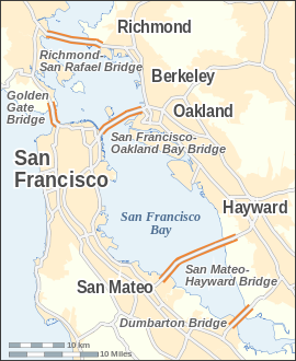
English: Map of the bridges of San Francisco Bay — in the San Francisco Bay Area, California.
|
| 日期 | |
| 來源 |
自己的作品 本vector image使用Inkscape創作 . |
| 作者 | Alexrk |
| 其他版本 | Derivative works of this file: San Francisco Bay Bridges map ar.pngDerivative works of this file: San Francisco Bay Bridges map ar.svg |

|
|

|
This SVG file contains embedded text that can be translated into your language, using any capable SVG editor, text editor or the SVG Translate tool. For more information see: About translating SVG files. |
授權條款
我,本作品的著作權持有者,決定用以下授權條款發佈本作品:
此檔案採用創用CC 姓名標示-相同方式分享 3.0 未在地化版本授權條款。
- 您可以自由:
- 分享 – 複製、發佈和傳播本作品
- 重新修改 – 創作演繹作品
- 惟需遵照下列條件:
- 姓名標示 – 您必須指名出正確的製作者,和提供授權條款的連結,以及表示是否有對內容上做出變更。您可以用任何合理的方式來行動,但不得以任何方式表明授權條款是對您許可或是由您所使用。
- 相同方式分享 – 如果您利用本素材進行再混合、轉換或創作,您必須基於如同原先的相同或兼容的條款,來分布您的貢獻成品。
檔案歷史
點選日期/時間以檢視該時間的檔案版本。
| 日期/時間 | 縮圖 | 尺寸 | 使用者 | 備註 | |
|---|---|---|---|---|---|
| 目前 | 2008年7月24日 (四) 14:14 | | 270 × 330(321 KB) | Alexrk | |
| 2008年7月19日 (六) 15:14 |  | 270 × 330(321 KB) | Alexrk | 2 Scales: km & mi | |
| 2008年7月19日 (六) 14:01 |  | 270 × 330(318 KB) | Alexrk | Scale, Size | |
| 2008年7月19日 (六) 13:49 |  | 287 × 347(317 KB) | Alexrk | Revise Labels, Background | |
| 2008年7月19日 (六) 13:42 |  | 287 × 347(306 KB) | Alexrk | Mess with fonts | |
| 2008年7月19日 (六) 13:33 |  | 287 × 347(314 KB) | Alexrk | {{Information |Description={{en|1=Locator Map of San Francisco Bay bridges}} |Source=Own work by uploader |Author=Alexrk |Date= |Permission= |other_versions= }} {{ImageUpload|full}} |
檔案用途
下列頁面有用到此檔案:
全域檔案使用狀況
以下其他 wiki 使用了這個檔案:
- arz.wikipedia.org 的使用狀況
- ast.wikipedia.org 的使用狀況
- bcl.wikipedia.org 的使用狀況
- bg.wikipedia.org 的使用狀況
- ca.wikipedia.org 的使用狀況
- cs.wikipedia.org 的使用狀況
- de.wikipedia.org 的使用狀況
- en.wikipedia.org 的使用狀況
- es.wikipedia.org 的使用狀況
- fi.wikipedia.org 的使用狀況
- fr.wikipedia.org 的使用狀況
- ga.wikipedia.org 的使用狀況
- gu.wikipedia.org 的使用狀況
- he.wikipedia.org 的使用狀況
- is.wikipedia.org 的使用狀況
- ml.wikipedia.org 的使用狀況
- my.wikipedia.org 的使用狀況
- pt.wikipedia.org 的使用狀況
- sco.wikipedia.org 的使用狀況
- sl.wikipedia.org 的使用狀況
- ta.wikipedia.org 的使用狀況
- th.wikipedia.org 的使用狀況
- uk.wikipedia.org 的使用狀況
檢視此檔案的更多全域使用狀況。