File:Submarine cables.png

預覽大小:641 × 600 像素。 其他解析度:257 × 240 像素 | 513 × 480 像素 | 1,021 × 955 像素。
原始檔案 (1,021 × 955 像素,檔案大小:81 KB,MIME 類型:image/png)
檔案歷史
點選日期/時間以檢視該時間的檔案版本。
| 日期/時間 | 縮圖 | 尺寸 | 使用者 | 備註 | |
|---|---|---|---|---|---|
| 目前 | 2019年10月7日 (一) 10:53 | | 1,021 × 955(81 KB) | Bjh21 | Reverted to version as of 19:07, 13 August 2007 (UTC): Waldyrious and User:Μυρμηγκάκι have already reverted this version, which is an objection under COM:OVERWRITE. Also the world map is already available at File:World map of submarine cables.png. |
| 2019年10月7日 (一) 03:27 |  | 1,601 × 1,025(74 KB) | Rarelibra | Reverted to version as of 07:57, 2 October 2008 (UTC) | |
| 2008年12月21日 (日) 13:09 |  | 1,021 × 955(81 KB) | Waldyrious | Reverted to original version. Other versions will be uploaded separately. | |
| 2008年10月2日 (四) 12:55 |  | 1,025 × 614(16 KB) | Rarelibra | Reverted to version as of 22:13, 1 February 2008 | |
| 2008年10月2日 (四) 07:57 |  | 1,601 × 1,025(74 KB) | Μυρμηγκάκι | Reverted to version as of 23:22, 22 August 2007 | |
| 2008年2月1日 (五) 22:13 |  | 1,025 × 614(16 KB) | Rarelibra | Updated example of a submarine cable in the North Sea. The blue line depicts the ACTUAL location of the submarine cable, taken from GPS coordinates of the cable. The red line depicts the REPRESENTATIVE location of the submarine cable. | |
| 2007年8月22日 (三) 23:22 |  | 1,601 × 1,025(74 KB) | Rarelibra | Updated map with cables around the world. | |
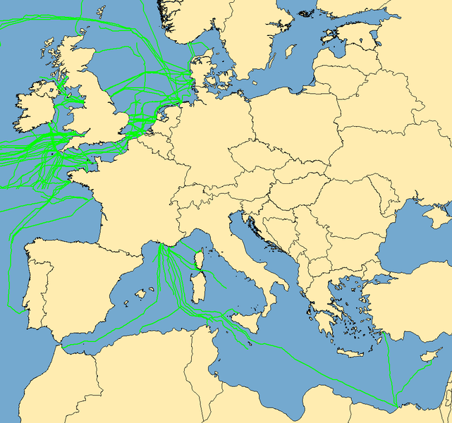
| 2007年8月13日 (一) 19:07 |  | 1,021 × 955(81 KB) | Rarelibra | Map with examples of submarine communications cables in Europe (Mediterranean Sea, English Channel, and North Sea). Data taken from public sources for fishermen and is therefore not restricted in any sense. Created by ~~~~ for public domain use, using Map |
檔案用途
沒有使用此檔案的頁面。
全域檔案使用狀況
以下其他 wiki 使用了這個檔案:
- da.wikipedia.org 的使用狀況
- de.wikipedia.org 的使用狀況
- en.wikipedia.org 的使用狀況