File:Wutip 2019-02-25 0345Z.jpg
預覽大小:450 × 600 像素。 其他解析度:180 × 240 像素 | 360 × 480 像素 | 576 × 768 像素 | 768 × 1,024 像素 | 1,536 × 2,048 像素 | 4,200 × 5,600 像素。
原始檔案 (4,200 × 5,600 像素,檔案大小:6.1 MB,MIME 類型:image/jpeg)
摘要
| 描述 |
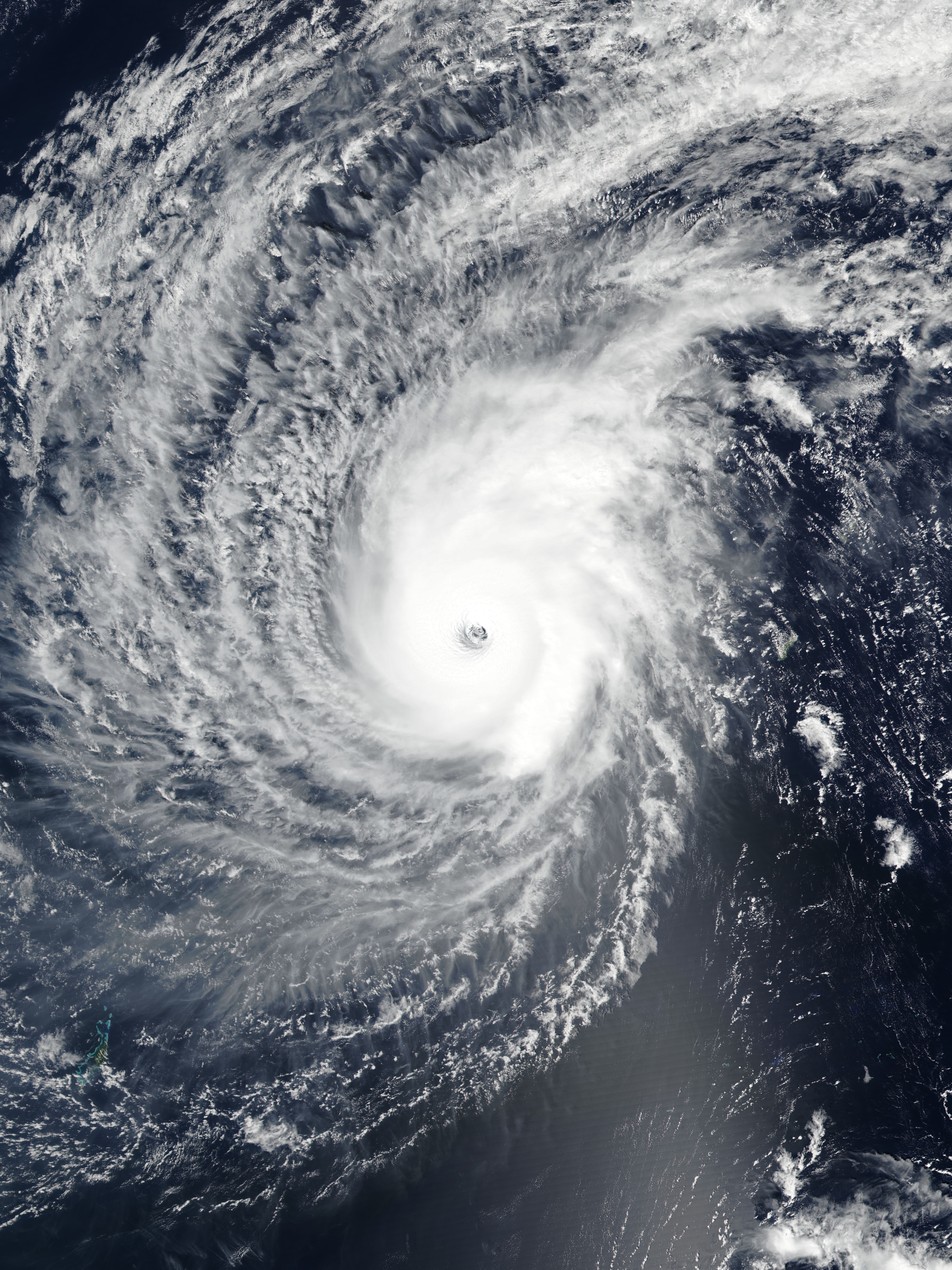
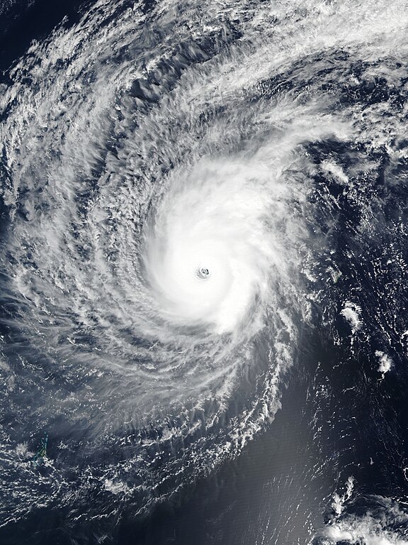
English: Typhoon Wutip near its secondary peak intensity west of Guam on February 25, 2019. |
| 日期 | |
| 來源 | EOSDIS Worldview |
| 作者 | VIIRS image captured by NOAA’s Suomi NPP satellite |
| 拍攝地點 | | 位於此地的本圖片與其他圖片: OpenStreetMap |
|---|
授權條款
| 本作品由NASA創作,屬於公有領域。根據NASA的版權政策:“NASA的創作除非另有聲明否則不受版權保護。”(參見:Template:PD-USGov/zh,NASA版權政策或JPL圖像使用政策) | ||
 |
警告:
|
檔案歷史
點選日期/時間以檢視該時間的檔案版本。
| 日期/時間 | 縮圖 | 尺寸 | 使用者 | 備註 | |
|---|---|---|---|---|---|
| 目前 | 2019年2月25日 (一) 13:58 | | 4,200 × 5,600(6.1 MB) | Meow | Rebuilt and optimised the picture with the accurate resolution (375m), the proper ratio (also narrowed to 97.6%), and the correct location of the center. |
| 2019年2月25日 (一) 11:49 |  | 6,401 × 8,001(3.84 MB) | Nino Marakot | 250m resolution | |
| 2019年2月25日 (一) 07:29 |  | 1,324 × 1,839(350 KB) | ElenaCyclone | User created page with UploadWizard |
檔案用途
下列頁面有用到此檔案:
全域檔案使用狀況
以下其他 wiki 使用了這個檔案:
- en.wikipedia.org 的使用狀況
- Portal:Tropical cyclones/Anniversaries/February
- Portal:Tropical cyclones/Anniversaries/February/23
- Wikipedia:WikiProject Tropical cyclones/Newsletter/Archive 35
- User talk:CooperScience
- User talk:KN2731/Archive 2
- Tropical cyclones in 2019
- User talk:Hurricane Noah/Archive 2
- User talk:Nova Crystallis/Archive 5
- User talk:Yellow Evan/Archive 28
- es.wikipedia.org 的使用狀況
- ja.wikipedia.org 的使用狀況
- ko.wikipedia.org 的使用狀況
- pt.wikipedia.org 的使用狀況
- th.wikipedia.org 的使用狀況
- tl.wikipedia.org 的使用狀況
- zh-yue.wikipedia.org 的使用狀況