Bishop_tuff.jpg (800 × 500像素,文件大小:139 KB,MIME类型:image/jpeg


摘要

描述
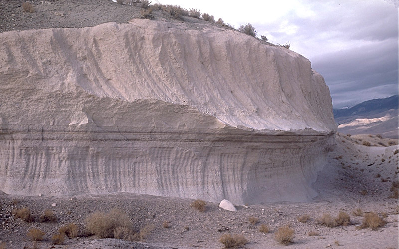
English: Photo showing two layers of Bishop tuff, eastern California, United States.
This outcrop is exposed in a rock quarry in Chalfant Valley about 25 km southeast of Long Valley Caldera. The two main units of the Bishop Tuff deposit are visible here: (1) the lower 5 m of the section consists of the pumice that fell to the ground (airfall pumice) downwind from the eruption; and (2) the upper 5-6 m of the section consists of the basal part of the pyroclastic flows that swept at hurricane speed away from the eruption. The thin dark "layers" just below the contact between the units are stains from an ancient groundwater table (manganese oxide stains).
日期 摄于1987年10月29日
来源 Archived source link
作者 Roy A. Bailey

许可协议

Public domain
本图片在美国属于公有领域,因为其只包含最初来自美国内政部下属机构美国地质调查局的材料。更多信息请参见USGS官方版权方针

Bahasa Indonesia  català  čeština  Deutsch  eesti  English  español  français  galego  italiano  Nederlands  português  polski  sicilianu  suomi  Tiếng Việt  Türkçe  български  македонски  русский  മലയാളം  한국어  日本語  中文  中文(简体)  中文(繁體)  العربية  فارسی  +/−

说明

添加一行文字以描述该文件所表现的内容
Layers of Bishop tuff

此文件中描述的项目

描繪內容

image/jpeg

defa794aa32309b7503c5190481b3a16acab6fc3

142,049 字节

500 像素

800 像素

文件历史

点击某个日期/时间查看对应时刻的文件。

日期/时间缩⁠略⁠图大小用户备注
当前2007年4月15日 (日) 04:582007年4月15日 (日) 04:58版本的缩略图800 × 500(139 KB)Hike395{{Information |Description = Photo showing two layers of Bishop tuff, eastern California, United States |Source = http://lvo.wr.usgs.gov/gallery/30714277-048_caption.html |Date = 1987-10-29 |Author = Roy A. Bailey |Permission = }} USGS

以下页面使用本文件:

全域文件用途

以下其他wiki使用此文件:

元数据