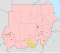
File:Sudanese Internal Conflict.svg

此SVG文件的PNG预览的大小:684 × 600像素。 其他分辨率:274 × 240像素 | 548 × 480像素 | 876 × 768像素 | 1,168 × 1,024像素 | 2,336 × 2,048像素 | 1,654 × 1,450像素。
原始文件 (SVG文件,尺寸为1,654 × 1,450像素,文件大小:382 KB)
文件历史
点击某个日期/时间查看对应时刻的文件。
| 日期/时间 | 缩略图 | 大小 | 用户 | 备注 | |
|---|---|---|---|---|---|
| 当前 | 2016年6月6日 (一) 18:25 |  | 1,654 × 1,450(382 KB) | Ermanarich | Update, derived from the Template. |
| 2016年5月3日 (二) 20:20 |  | 1,654 × 1,450(380 KB) | Ermanarich | Added towns and villages in South Kordofan under the control of SPLA-N and two contested settlements in Southern Darfur. | |
| 2016年2月21日 (日) 05:50 |  | 1,654 × 1,450(357 KB) | Oganesson007 | User created page with UploadWizard |
文件用途
以下页面使用本文件:
全域文件用途
以下其他wiki使用此文件:
- ar.wikipedia.org上的用途
- ast.wikipedia.org上的用途
- azb.wikipedia.org上的用途
- be.wikipedia.org上的用途
- ca.wikipedia.org上的用途
- da.wikipedia.org上的用途
- din.wikipedia.org上的用途
- en.wikipedia.org上的用途
- es.wikipedia.org上的用途
- fa.wikipedia.org上的用途
- fr.wikipedia.org上的用途
- incubator.wikimedia.org上的用途
- pnb.wikipedia.org上的用途
- pt.wikipedia.org上的用途
- ru.wikipedia.org上的用途
- simple.wikipedia.org上的用途
- th.wikipedia.org上的用途
- tr.wikipedia.org上的用途
- uk.wikipedia.org上的用途
- ur.wikipedia.org上的用途
- www.wikidata.org上的用途


