欧登堡 (印第安纳州)
欧登堡(英语:Oldenburg)是一个位于美国印第安纳州富兰克林县的城镇,根据2010年人口普查,该镇人口为674人。
| 欧登堡 | |
|---|---|
| 城镇 | |
| Oldenburg, Indiana | |
 | |
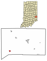
 Location of Oldenburg in Franklin County, Indiana. | |
| 坐标:39°20′22″N 85°12′17″W / 39.33944°N 85.20472°W | |
| 国家 | 美国 |
| 州 | 印第安纳州 |
| 县 | 富兰克林县 |
| 面积[1] | |
| • 总计 | 0.44 平方英里(1.13 平方公里) |
| • 陆地 | 0.43 平方英里(1.12 平方公里) |
| • 水域 | 0.00 平方英里(0.01 平方公里) |
| 海拔 | 889 英尺(271 米) |
| 人口(2010)[2] | |
| • 总计 | 674人 |
| • 估计(2016)[3] | 661 |
| • 密度 | 1,523.04人/平方英里(588.56人/平方公里) |
| 时区 | EST(UTC-5) |
| • 夏时制 | EDT(UTC-4) |
| 邮编 | 47036 |
| 电话区号 | 812 |
| FIPS code | 18-56286[4] |
| GNIS标识码 | 0449704[5] |
地理
编辑欧登堡座标位于39°20′22″N 85°12′17″W / 39.33944°N 85.20472°W (39.339474,-85.204640).[6]
根据到2010年人口普查结果,欧登堡总面积为0.43平方英里(1.11平方千米),境内所有面积皆为陆地。[7]
历史
编辑1837年,一群来自德国的居民长期定居于欧登堡[8], 该镇也因德国奥尔登堡而得名[9]。 1881年,欧登堡因其镇内众多的教堂和宗教教育机构而被称为“尖顶村”[10]。 1851年,修女Theresa Hackelmeier(1827-1860)在澳登堡创办了Sisters of St. Francis of Oldenburg。
人口统计
编辑2010年人口普查
编辑- 总人口数共674人、235个家庭,其中156个家庭居住在该镇中。
- 人口密度为1,567.4名居民每平方英里(605.2名居民每平方千米)
- 居民种族构成为98.5%白种人、0.1%非洲裔美国人,0.6%其他种族和其余两个或多个总族人种约0.7%。 西语裔或 拉丁裔人口约占1.9%。
- 235个家庭当中,30.6%的家庭与年龄在18岁以下的儿女一起生活、52.3%为同居已婚夫妇、10.6%为寡户、3.4%为鳏户。29.4%的家庭是由个人组成,当中有14.9%为65岁以上独居生活。 平均家庭人口是2.39人和平均家庭规模为2.97人。
- 年龄中位数为51岁。18岁以下的居民占20.6%、18和24岁占5.8%、25至44岁占17.3%、45至64岁占26.7%、65岁或以上人口占29.5%%。
- 男女比为男性39.3%、女性60.7%。
| 调查年 | 人口 | 备注 | %± |
|---|---|---|---|
| 1860 | 300 | — | |
| 1870 | 160 | −46.7% | |
| 1880 | 673 | 320.6% | |
| 1890 | 690 | 2.5% | |
| 1900 | 957 | 38.7% | |
| 1910 | 956 | −0.1% | |
| 1920 | 628 | −34.3% | |
| 1930 | 575 | −8.4% | |
| 1940 | 533 | −7.3% | |
| 1950 | 591 | 10.9% | |
| 1960 | 694 | 17.4% | |
| 1970 | 758 | 9.2% | |
| 1980 | 770 | 1.6% | |
| 1990 | 715 | −7.1% | |
| 2000 | 647 | −9.5% | |
| 2010 | 674 | 4.2% | |
| 2016年估计 | 661 | [3] | −1.9% |
| U.S. Decennial Census[12] | |||
参考文献
编辑- ^ 2016 U.S. Gazetteer Files. United States Census Bureau. [Jul 28, 2017]. (原始内容存档于2017-08-24).
- ^ 2.0 2.1 American FactFinder. 美国普查局. [2012-12-11]. (原始内容存档于2015-03-28).
- ^ 3.0 3.1 Population and Housing Unit Estimates. [June 9, 2017]. (原始内容存档于2018-06-13).
- ^ American FactFinder. 美国普查局. [2008-01-31]. (原始内容存档于2013-09-11).
- ^ US Board on Geographic Names. 美国地质调查局. 2007-10-25 [2008-01-31]. (原始内容存档于2012-02-26).
- ^ US Gazetteer files: 2010, 2000, and 1990. 美国普查局. 2011-02-12 [2011-04-23]. (原始内容存档于2002-05-27).
- ^ G001 - Geographic Identifiers - 2010 Census Summary File 1. 美国普查局. [2015-07-17]. (原始内容存档于2020-02-13).
- ^ Hunter, David. Shifra Stein's Day Trips from Cincinnati: Getaways Less Than Two Hours Away.. Globe Pequot. 2003.10.1: 8.
- ^ Oldenburg. www.franklincountyhistoricalsociety.com. [2018-06-22]. (原始内容存档于2016-08-31) (英语).
- ^ Reifel, August Jacob. History of Franklin County, Indiana: Her People, Industries, and Institutions : with Biographical Sketches of Representative Citizens and Genealogical Records of Old Families. History of Franklin County, Indiana. Windmill Publications. 1915 [2018-06-22]. (原始内容存档于2018-06-22) (英语).
- ^ Download. npgallery.nps.gov. [2018-06-22]. (原始内容存档于2021-02-28) (英语).
- ^ Census of Population and Housing. Census.gov. [June 4, 2015]. (原始内容存档于2015-05-12).