File:Map of Bangladesh-de.svg

此SVG文件的PNG预览的大小:485 × 599像素。 其他分辨率:194 × 240像素 | 388 × 480像素 | 621 × 768像素 | 828 × 1,024像素 | 1,657 × 2,048像素 | 1,678 × 2,074像素。
原始文件 (SVG文件,尺寸为1,678 × 2,074像素,文件大小:3.72 MB)
摘要
| 描述 |
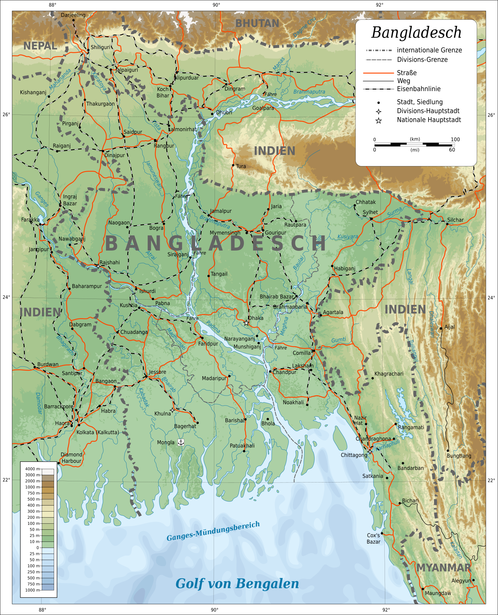
Deutsch: Topografische Karte von Bangladesch. English: Topographic map of Bangladesh. Lambert Conformal Conic projection, standard parallels 22°N/26°N, center longitude 90°E.
Suomi: Bangladeshin topografinen kartta.
Русский: Топографическая карта Бангладеш. |
||
| 日期 | |||
| 来源 |
|
||
| 作者 | Oona Räisänen (Mysid) | ||
| 授权 (二次使用本文件) |
我,本作品著作权人,特此采用以下许可协议发表本作品:
本文件采用知识共享署名 3.0 未本地化版本许可协议授权。
您可以选择您需要的许可协议。 |
||
| 其他版本 |
[]
|
||
| SVG开发 |


|
This SVG file contains embedded text that can be translated into your language, using any capable SVG editor, text editor or the SVG Translate tool. For more information see: About translating SVG files. |
文件历史
点击某个日期/时间查看对应时刻的文件。
| 日期/时间 | 缩略图 | 大小 | 用户 | 备注 | |
|---|---|---|---|---|---|
| 当前 | 2018年4月5日 (四) 23:29 | | 1,678 × 2,074(3.72 MB) | Furfur | typos |
| 2016年3月3日 (四) 20:03 |  | 1,678 × 2,074(3.72 MB) | Furfur | Details | |
| 2016年1月3日 (日) 02:07 |  | 1,678 × 2,074(3.71 MB) | Furfur | now valid svg | |
| 2016年1月3日 (日) 01:28 |  | 1,678 × 2,074(3.71 MB) | Furfur | Details | |
| 2015年12月31日 (四) 10:15 |  | 1,678 × 2,074(3.71 MB) | Furfur | Reverted to version as of 09:47, 31 December 2015 (UTC) - does work file not rendered properly | |
| 2015年12月31日 (四) 10:14 |  | 1,678 × 2,074(3.17 MB) | Furfur | neuer Versuch (SVG cleanup) | |
| 2015年12月31日 (四) 09:47 |  | 1,678 × 2,074(3.71 MB) | Furfur | new try ... | |
| 2015年12月30日 (三) 22:12 |  | 1,678 × 2,074(3.16 MB) | Furfur | rendering the preview is incorrect - the final image is fine, however ... | |
| 2015年12月30日 (三) 21:47 |  | 1,678 × 2,074(3.16 MB) | Furfur | the darkening of surrounding India does not make sense in my opinion - the color legend should also be valid for India | |
| 2015年1月24日 (六) 01:56 |  | 1,678 × 2,074(3.75 MB) | Furfur | typo |
文件用途
以下3个页面使用本文件:
全域文件用途
以下其他wiki使用此文件:
- de.wikipedia.org上的用途
- frr.wikipedia.org上的用途
- he.wikipedia.org上的用途
- ja.wikipedia.org上的用途
- trv.wikipedia.org上的用途
- www.wikidata.org上的用途