Testing map functionality
编辑
Label is bold
photo and map_relief not specified
编辑
map_relief=1 and no name
编辑
左右对比| {{Infobox mountain}} | {{Infobox mountain/sandbox}} |
|---|
| Ben Nevis |
|---|
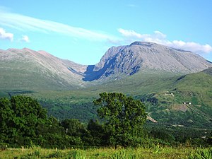 Ben Nevis from Banavie. The summit is beyond and to the left of the apparent highest point. | | 译名 | Venomous mountain or mountain with its head in the clouds(Scottish Gaelic language) |
|---|
|
| 海拔 | 1,344米(4,409英尺) |
|---|
| 地形突起度 | 1,344米(4,409英尺)Ranked 1st in British Isles |
|---|
| 母峰 | none - HP Great Britain |
|---|
| 列表 | Munro, Marilyn, Council top (Highland), County top (Inverness-shire) |
|---|
| 坐标 | 56°47′49″N 5°00′17″W / 56.796986°N 5.004784°W / 56.796986; -5.004784 |
|---|
|
| | 位置 | Lochaber,  苏格兰 苏格兰 |
|---|
| OS格网系统 | NN166713 |
|---|
| 地形图 | OS Landranger 41, Explorer 392 |
|---|
|
| 首次登顶 | 17 August 1771, by James Robertson |
|---|
| 最简路线 | Walk |
|---|
|
|
Mount Fuji w/o photo or map
编辑
Test of an infobox without a photo.
Another photo-free test case
Aiguille de Tré la Tête
编辑
Test rounding of elevation and prominence
Popular range articles
编辑
左右对比| {{Infobox mountain}} | {{Infobox mountain/sandbox}} |
|---|
Andes
Quechua: Anti(s/kuna) |
|---|
 | 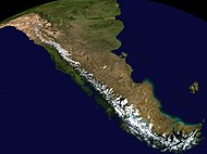 Composite satellite image of the southern Andes | |
| 山峰 | Aconcagua(Las Heras Department, Mendoza, Argentina) |
|---|
| 海拔 | 6,962米(22,841英尺) |
|---|
| 坐标 | 32°39′10″S 70°0′40″W / 32.65278°S 70.01111°W / -32.65278; -70.01111 |
|---|
|
| 长度 | 7,000千米(4,300英里) |
|---|
| 宽度 | 500千米(310英里) |
|---|
|
| 国家 | Argentina、Bolivia、Chile、Colombia、Ecuador、Peru和Venezuela |
|---|
| 聚居地 | Bogotá, Santiago, Medellín, La Paz, Cali, Quito, Pasto, Mérida, Arequipa, Mendoza, Cuenca, Cochabamba, Pereira, Ibagué, Salta, Manizales, Cúcuta, Cusco and Bucaramanga |
|---|
|
|
左右对比| {{Infobox mountain}} | {{Infobox mountain/sandbox}} |
|---|
| Catskill Mountains |
|---|
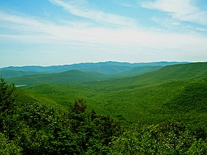 Slide Mountain and the peaks around it as seen from Twin Mountain in the northern Catskills. | 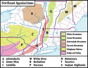 Map of the main regions of the northeast Appalachians, with the Catskills as "C". | |
| 山峰 | Slide Mountain(S of Shandaken) |
|---|
| 海拔 | 4,154英尺(1,266米) |
|---|
| 坐标 | 41°59′55″N 74°23′11″W / 41.99861°N 74.38639°W / 41.99861; -74.38639 |
|---|
|
| 长度 | 111英里(179千米) N/S |
|---|
| 宽度 | 102英里(164千米) E/W |
|---|
| 面积 | 15,259平方英里(39,520平方千米) |
|---|
|
| 国家 | United States |
|---|
| 州或邦 | New York |
|---|
| 地区 | Hudson Valley |
|---|
| Counties | Ulster, Greene, Sullivan, Delaware and Schoharie |
|---|
| Communities | Hunter, Tannersville, Monticello and Liberty |
|---|
| 所属山脉 | Appalachian |
|---|
| 边界 | Poconos和Shawangunk Ridge |
|---|
|
| 岩石年代 | Devonian和Mississippian |
|---|
| 岩石类型 | Sedimentary |
|---|
|
|
map only, dim parameter
编辑
Range coordinates that are difficult to round
编辑
Range coordinates specified only by degrees
编辑
Country_type parameter
编辑


