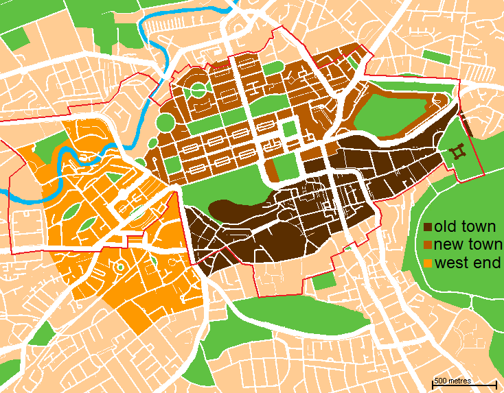
File:Edinburgh map.png
Edinburgh_map.png (734 × 573像素,文件大小:69 KB,MIME类型:image/png)
文件历史
点击某个日期/时间查看对应时刻的文件。
| 日期/时间 | 缩略图 | 大小 | 用户 | 备注 | |
|---|---|---|---|---|---|
| 当前 | 2009年11月8日 (日) 00:03 |  | 734 × 573(69 KB) | Jrockley | altered to depict new town, old town, and west end instead. also now shows boundary of world heritage site. |
| 2007年11月19日 (一) 02:58 |  | 610 × 516(47 KB) | Jrockley | more greenery | |
| 2007年11月16日 (五) 17:32 |  | 610 × 516(46 KB) | Jrockley | move "Edinburgh" | |
| 2007年11月16日 (五) 03:43 |  | 610 × 516(47 KB) | Jrockley | more greenery | |
| 2007年11月16日 (五) 03:20 |  | 610 × 516(47 KB) | Jrockley | clearer map, based on Google data | |
| 2007年11月16日 (五) 01:19 |  | 500 × 432(30 KB) | Jrockley | {{Information |Description= Map of Central Edinburgh, showing New and Old Towns. |Source=Based loosely on http://www.aboutscotland.com/edin/newtown.html |Date=~~~~~ |Author=~~~ |Permission={{PD-self}} |other_versions= }} |
文件用途
全域文件用途
以下其他wiki使用此文件:
- af.wikipedia.org上的用途
- ang.wikipedia.org上的用途
- ba.wikipedia.org上的用途
- be.wikipedia.org上的用途
- ca.wikipedia.org上的用途
- cs.wikipedia.org上的用途
- de.wikipedia.org上的用途
- en.wikipedia.org上的用途
- Edinburgh
- Areas of Edinburgh
- New Town, Edinburgh
- Old Town, Edinburgh
- Talk:Edinburgh/Archive 2
- Wikipedia talk:WikiProject Edinburgh
- West End, Edinburgh
- List of Category A listed buildings in Edinburgh
- List of Category A listed buildings in the Old Town, Edinburgh
- List of Category A listed buildings in the New Town, Edinburgh
- es.wikipedia.org上的用途
- eu.wikipedia.org上的用途
- fi.wikipedia.org上的用途
- fr.wikipedia.org上的用途
- ga.wikipedia.org上的用途
- gl.wikipedia.org上的用途
- he.wikipedia.org上的用途
- hi.wikipedia.org上的用途
- hr.wikipedia.org上的用途
- hy.wikipedia.org上的用途
- ja.wikipedia.org上的用途
- kn.wikipedia.org上的用途
- ko.wikipedia.org上的用途
- nl.wikipedia.org上的用途
- pt.wikipedia.org上的用途
- ru.wikipedia.org上的用途
- sco.wikipedia.org上的用途
查看此文件的更多全域用途。


