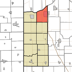
林肯镇区 (印地安纳州牛顿县)
林肯镇区是美国印地安纳州牛顿县的10个镇区之一。截至2010年美国人口普查,其人口为4480,共1734住房。[2]
| 林肯镇区 Lincoln Township | |
|---|---|
| 镇区 | |
 在牛顿县中的位置 | |
| 坐标:41°08′06″N 87°19′27″W / 41.13500°N 87.32417°W | |
| 国家 | |
| 州 | |
| 县 | 牛顿县 |
| 面积 | |
| • 总计 | 42.56 平方英里(100 平方公里) |
| • 陆地 | 42.39 平方英里(100 平方公里) |
| • 水域 | 0.16 平方英里(0.4 平方公里) 0% |
| 海拔[1] | 679 英尺(207 公尺) |
| 人口(2010) | |
| • 总计 | 4,480人 |
| • 密度 | 106人/平方英里(41人/平方公里) |
| 电话区号 | 219 |
| GNIS ID | 453572 |
历史
编辑林肯镇区于1872年成立。[3]
地理
编辑根据2010年美国人口普查,该镇的总面积为42.56平方英里(110.2平方千米),其中土地面积42.39平方英里(109.8平方千米),水域面积为0.16平方英里(0.41平方千米)。[2]
参考文献
编辑- ^ US Board on Geographic Names. United States Geological Survey. 2007-10-25 [2008-01-31]. (原始内容存档于2012-02-26).
- ^ 2.0 2.1 Population, Housing Units, Area, and Density: 2010 - County -- County Subdivision and Place -- 2010 Census Summary File 1. United States Census. [2013-05-10]. (原始内容存档于2020-02-12).
- ^ A standard history of Jasper and Newton counties, Indiana. Lewis Publishing Company. 1916: 198.
外部链接
编辑- Indiana Township Association (页面存档备份,存于互联网档案馆)
- United Township Association of Indiana (页面存档备份,存于互联网档案馆)
| 这是一篇关于印第安纳州的地理小作品。您可以通过编辑或修订扩充其内容。 |