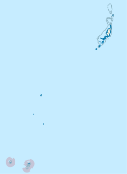
哈托博海伊州
哈托博海伊州是太平洋島國帛琉16個行政區之一,位於帛琉最南端,包含托比島和海倫環礁,首府是哈托博海伊,土地面積0.88平方公里。人口在1962年至2000年逐漸下降,其後2005年人口回升至44。
| 哈托博海伊州 Tobi Hatohobei | |
|---|---|
| 州 | |
 在帕勞的位置 | |
| 坐標:3°00′21″N 131°07′26″E / 3.0058°N 131.1239°E | |
| 國家 | |
| 首府 | Hatohobei |
| 面積 | |
| • 總計 | 0.9 平方公里(0.3 平方英里) |
| • 陸地 | 0.9 平方公里(0.3 平方英里) |
| • 水域 | 0 平方公里(0 平方英里) |
| 人口(2021)[1] | |
| • 總計 | 25人 |
| • 密度 | 27.8人/平方公里(71.9人/平方英里) |
| ISO 3166碼 | PW-050 |
參考資料
編輯- ^ 2015 Census of Population, Housing and Agriculture for the Republic of Palau (PDF). Palau Government. Office of Planning and Statistics. [2022-02-04]. (原始內容存檔 (PDF)於2017-10-16).
外部連結
編輯- Links to pictures and maps of Tobi and Palau.
- Aerial view of the island of Tobi[永久失效連結].
- KiteLines FALL 1977 (Vol. 1 No. 3) Articles on Kite Fishing on Tobi.
- Helen Reef
- Seacology Helen Reef Project Seacology
3°00′21″N 131°07′26″E / 3.0058°N 131.1239°E
| 這是一篇與帛琉相關的小作品。您可以透過編輯或修訂擴充其內容。 |
