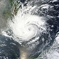
File:Pakhar 2012-03-30.jpg

預覽大小:466 × 599 像素。 其他解析度:187 × 240 像素 | 373 × 480 像素 | 597 × 768 像素 | 796 × 1,024 像素 | 1,593 × 2,048 像素 | 5,600 × 7,200 像素。
原始檔案 (5,600 × 7,200 像素,檔案大小:4.97 MB,MIME 類型:image/jpeg)
檔案歷史
點選日期/時間以檢視該時間的檔案版本。
| 日期/時間 | 縮圖 | 尺寸 | 使用者 | 備註 | |
|---|---|---|---|---|---|
| 目前 | 2023年8月16日 (三) 11:17 |  | 5,600 × 7,200(4.97 MB) | Nino Marakot | Original image |
| 2012年12月4日 (二) 13:22 |  | 5,600 × 7,200(8.19 MB) | Earth100 | Official version, in natural, original shape, color and in higher definition. | |
| 2012年10月28日 (日) 15:50 |  | 6,696 × 8,556(45.63 MB) | Supportstorm | Reverted to version as of 05:44, 14 October 2012 The color was exactly as it was captured by the satellite; original HDF Quality. | |
| 2012年10月24日 (三) 05:48 |  | 6,262 × 8,290(17.47 MB) | Earth100 | Cropped to center, restored original color. | |
| 2012年10月14日 (日) 05:44 |  | 6,696 × 8,556(45.63 MB) | Supportstorm | Better Quality using original HDF Files | |
| 2012年3月30日 (五) 12:26 |  | 6,000 × 6,000(7.66 MB) | Meow |
檔案用途
下列3個頁面有用到此檔案:
全域檔案使用狀況
以下其他 wiki 使用了這個檔案:
- de.wikipedia.org 的使用狀況
- en.wikipedia.org 的使用狀況
- ja.wikipedia.org 的使用狀況
- ko.wikipedia.org 的使用狀況
- pt.wikipedia.org 的使用狀況
- th.wikipedia.org 的使用狀況
- vi.wikipedia.org 的使用狀況


