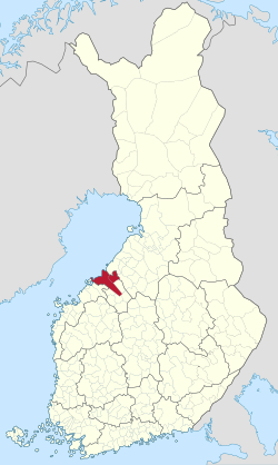
科科拉次區
科科拉次區(芬蘭語:Kokkolan seutukunta;瑞典語:Karleby ekonomiska region),是芬蘭中博滕區的一個次區,在歐盟一級地方行政單位統計區(LAU 1,即舊的 NUTS 4)中的代碼為162[6],在GeoNames中的代碼則為9610671[1]。其人口共53183人[3];面積1958.08平方公里(其中陸地面積1913.77平方公里,水域面積44.31平方公里)[2]。
| 科科拉次區 Kokkolan seutukunta | |
|---|---|
| 次區 | |
 | |
| 坐標:63°51′15″N 23°35′08″E / 63.85414°N 23.58562°E[1] | |
| 國家 | |
| 行政區 | 中博滕區 |
| 面積[2] | |
| • 總計 | 1,958.08 平方公里(756.02 平方英里) |
| • 陸地 | 1,913.77 平方公里(738.91 平方英里) |
| • 水域 | 44.31 平方公里(17.11 平方英里) |
| 人口(2020)[3] | |
| • 總計 | 53,183人 |
| • 密度 | 27.2人/平方公里(70.3人/平方英里) |
| 時區 | EET[4](UTC+2) |
| • 夏時制 | EEST[5](UTC+3) |
| GeoNames[1] | 9610671 |
| LAU 1(NUTS 4)[6] | 162 |
行政區劃
編輯人口變化
編輯參考資料
編輯- ^ 1.0 1.1 1.2 GeoNames - Kokkola (9610671). GeoNames. [2020-07-14] (英語).
- ^ 2.0 2.1 Pinta-alat kunnittain (Excel) 2020-01-01. Maanmittauslaitos. 2020-01-01 [2020-07-13]. (原始內容存檔於2020-07-10) (芬蘭語).
- ^ 3.0 3.1 Väestörakenteen ennakkotiedot alueittain, 2020M01*-2020M05*. Tilastokeskus. 2020-01-31 [2020-07-13]. (原始內容存檔於2020-12-14) (芬蘭語).
- ^ Current Local Time in Helsinki, Finland. Time and Date. (原始內容存檔於2020-08-04) (英語).
- ^ Clock Changes in Helsinki, Finland. Time and Date. (原始內容存檔於2020-08-04) (英語).
- ^ 6.0 6.1 Förteckning över ekonomiska regioner. Statistikcentralen. [2013-12-25]. (原始內容存檔於2013-11-11) (瑞典語).
- ^ Finlands regionindelning på. www.patio.fi. (原始內容存檔於2012-10-22) (芬蘭語).
- ^ Väestö kielen mukaan sekä ulkomaan kansalaisten määrä ja maa-pinta-ala alueittain 1980 - 2016. Tilastokeskus. [2018-01-18]. (原始內容存檔於2019-03-06) (芬蘭語).