卡克羅斯
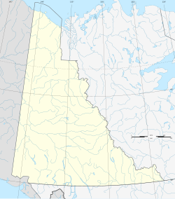
卡克羅斯(英語:Carcross,原文:Caribou Crossing,Tlingit:Nadashaa Héeni),加拿大育空地區的一個無建制社區,距離阿拉斯加公路74公里。該地總人口431(2008年6月)。
| 卡克羅斯 Carcross Caribou Crossing | |
|---|---|
| 非建制社區 | |
 | |
卡克羅斯在育空地區的位置 | |
| 坐標:60°10′03″N 134°42′26″W / 60.16750°N 134.70722°W | |
| 國家 | |
| 地區 | |
| 面積 | |
| • 總計 | 16.14 平方公里(6.23 平方英里) |
| 海拔 | 659 公尺(2,162 英尺) |
| 人口(2016年) | |
| • 總計 | 301人 |
| • 密度 | 18.6人/平方公里(48.3人/平方英里) |
| • 人口變化 2011-16 | ▲4.2% |
| 時區 | 太平洋時區(UTC-8) |
它位於白馬市的南偏東方向74公里,通過阿拉斯加公路和克朗代克公路可達。塔吉什公路的南端在卡克羅斯。卡克羅斯也位於懷特山口與育空鐵路上。
卡克羅斯主要以其在附近的蒙大拿山上的世界級山地自行車騎行而著稱,以及其北部的卡克羅斯沙漠被稱作「世界上最小的沙漠」。[1]
歷史
編輯人口統計
編輯根據2016年加拿大人口普查的數據,卡克羅斯共有人口301人[2]。
| 年份 | 人口 | ±% |
|---|---|---|
| 1941 | 162 | — |
| 1951 | 182 | +12.3% |
| 1981 | 218 | +19.8% |
| 1986 | 209 | −4.1% |
| 1991 | 183 | −12.4% |
| 1996 | 196 | +7.1% |
| 2001 | 152 | −22.4% |
| 2006 | 280 | +84.2% |
| 2011 | 289 | +3.2% |
| 2016 | 301 | +4.2% |
| 2021 | — | |
| 來源:加拿大統計局 [3][4][5][6][7][8][9][2] | ||
氣候
編輯卡克羅斯的氣候類型屬於亞寒帶地中海式氣候,在柯本氣候分類法歸類為Dsc型。全年嚴寒乾燥,在該鎮以北不遠處有世界上最小的沙漠卡克羅斯沙漠。年平均氣溫−2.4 °C(27.7 °F),最熱月是7月為14.2 °C(57.6 °F),而最冷月則是1月的−18.2 °C(−0.8 °F)。極端最高氣溫是32.5 °C(90.5 °F)在1992年7月1日錄得,而極端最低氣溫是1917年12月25日的−55.0 °C(−67.0 °F)。
| 卡克羅斯(1981-2010年平均數據,1907年至今極端數據) | |||||||||||||
|---|---|---|---|---|---|---|---|---|---|---|---|---|---|
| 月份 | 1月 | 2月 | 3月 | 4月 | 5月 | 6月 | 7月 | 8月 | 9月 | 10月 | 11月 | 12月 | 全年 |
| 歷史最高溫 °C(°F) | 8.9 (48.0) |
18.9 (66.0) |
13.5 (56.3) |
21.0 (69.8) |
28.0 (82.4) |
31.7 (89.1) |
32.5 (90.5) |
31.7 (89.1) |
26.7 (80.1) |
20.0 (68.0) |
13.3 (55.9) |
14.0 (57.2) |
32.5 (90.5) |
| 平均高溫 °C(°F) | −13.2 (8.2) |
−7.8 (18.0) |
−0.6 (30.9) |
7.3 (45.1) |
13.7 (56.7) |
19.3 (66.7) |
21.7 (71.1) |
20.6 (69.1) |
13.5 (56.3) |
5.6 (42.1) |
−3.7 (25.3) |
−7.3 (18.9) |
5.8 (42.4) |
| 日均氣溫 °C(°F) | −18.2 (−0.8) |
−13.9 (7.0) |
−7.8 (18.0) |
−0.7 (30.7) |
7.4 (45.3) |
12.5 (54.5) |
14.2 (57.6) |
13.0 (55.4) |
7.9 (46.2) |
1.1 (34.0) |
−7.7 (18.1) |
−11.6 (11.1) |
−0.3 (31.5) |
| 平均低溫 °C(°F) | −22.7 (−8.9) |
−20.0 (−4.0) |
−14.8 (5.4) |
−8.4 (16.9) |
1.0 (33.8) |
5.7 (42.3) |
6.7 (44.1) |
5.1 (41.2) |
2.3 (36.1) |
−3.4 (25.9) |
−11.4 (11.5) |
−15.7 (3.7) |
−6.3 (20.7) |
| 歷史最低溫 °C(°F) | −51.2 (−60.2) |
−48.3 (−54.9) |
−42.2 (−44.0) |
−32.8 (−27.0) |
−12.5 (9.5) |
−6.7 (19.9) |
−3.3 (26.1) |
−11.7 (10.9) |
−18.0 (−0.4) |
−30.0 (−22.0) |
−40.0 (−40.0) |
−55.0 (−67.0) |
−55.0 (−67.0) |
| 平均降水量 mm(吋) | 28.6 (1.13) |
23.4 (0.92) |
9.6 (0.38) |
5.5 (0.22) |
14.9 (0.59) |
28.5 (1.12) |
29.9 (1.18) |
28.1 (1.11) |
32.9 (1.30) |
27.0 (1.06) |
28.9 (1.14) |
22.5 (0.89) |
279.8 (11.02) |
| 平均降雨量 mm(吋) | 0.5 (0.02) |
0.0 (0.0) |
0.2 (0.01) |
1.5 (0.06) |
14.8 (0.58) |
28.5 (1.12) |
29.9 (1.18) |
28.0 (1.10) |
30.1 (1.19) |
17.1 (0.67) |
1.4 (0.06) |
0.2 (0.01) |
152.2 (5.99) |
| 平均降雪量 cm(吋) | 28.1 (11.1) |
23.4 (9.2) |
9.4 (3.7) |
4.0 (1.6) |
0.1 (0.0) |
0.0 (0.0) |
0.0 (0.0) |
0.1 (0.0) |
2.8 (1.1) |
9.9 (3.9) |
27.4 (10.8) |
22.4 (8.8) |
127.6 (50.2) |
| 平均降水天數(≥ 0.2 mm) | 7.5 | 6.0 | 3.5 | 2.1 | 4.7 | 6.4 | 8.1 | 7.4 | 9.0 | 7.9 | 7.3 | 6.5 | 76.3 |
| 平均降雨天數(≥ 0.2 mm) | 0.2 | 0.0 | 0.1 | 0.6 | 4.8 | 6.4 | 8.1 | 7.4 | 8.5 | 5.0 | 0.4 | 0.1 | 41.7 |
| 平均降雪天數(≥ 0.2 cm) | 7.3 | 6.0 | 3.4 | 1.5 | 0.1 | 0.0 | 0.0 | 0.0 | 0.7 | 3.5 | 7.1 | 6.5 | 35.9 |
| 數據來源:1981-2010 Environment Canada,[10] Source 2: May and June temp. averages | |||||||||||||
經濟
編輯卡克羅斯經濟以旅遊業為主。
參考來源
編輯- ^ MacEacheran, Mike. The unlikely home of the world's smallest desert. BBC Travel (BBC). 2018-06-22 [2018-06-24]. (原始內容存檔於2021-04-17).
- ^ 2.0 2.1 Population and dwelling counts, for Canada, provinces and territories, and census subdivisions (municipalities), 2016 and 2011 censuses – 100% data (Yukon). Statistics Canada. February 8, 2017 [January 30, 2022]. (原始內容存檔於2017-02-11).
- ^ Ninth Census of Canada, 1951 (PDF). SP-7 (Population: Unincorporated villages and hamlets). Dominion Bureau of Statistics. March 31, 1954 [February 2, 2022]. (原始內容存檔 (PDF)於2021-11-28).
- ^ 1986 Census: Population - Census Divisions and Census Subdivisions (PDF). Statistics Canada. September 1987 [January 30, 2022]. (原始內容存檔 (PDF)於2020-05-08).
- ^ 91 Census: Census Divisions and Census Subdivisions - Population and Dwelling Counts (PDF). Statistics Canada. April 1992 [January 30, 2022]. (原始內容存檔 (PDF)於2020-05-08).
- ^ 96 Census: A National Overview - Population and Dwelling Counts (PDF). Statistics Canada. April 1997 [January 30, 2022]. (原始內容存檔 (PDF)於2021-11-28).
- ^ Population and Dwelling Counts, for Canada, Provinces and Territories, and Census Subdivisions (Municipalities), 2001 and 1996 Censuses - 100% Data (Yukon Territory). Statistics Canada. August 15, 2012 [January 30, 2022]. (原始內容存檔於2022-02-01).
- ^ 2006 Census Corrections and updates. Statistics Canada. June 23, 2009 [January 30, 2022]. (原始內容存檔於2021-12-16).
- ^ Population and dwelling counts, for Canada, provinces and territories, and census subdivisions (municipalities), 2011 and 2006 censuses (Yukon). Statistics Canada. July 25, 2021 [January 30, 2022]. (原始內容存檔於2022-02-01).
- ^ Carcross (CSV (2874 KB)). Canadian Climate Normals 1981–2010. Environment Canada. [2014-02-20]. Climate ID: 2100200.[永久失效連結]
