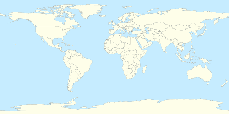
File:World location map.svg

此 SVG 檔案的 PNG 預覽的大小:800 × 400 像素。 其他解析度:320 × 160 像素 | 640 × 320 像素 | 1,024 × 512 像素 | 1,280 × 640 像素 | 2,560 × 1,280 像素。
原始檔案 (SVG 檔案,表面大小:800 × 400 像素,檔案大小:595 KB)
檔案歷史
點選日期/時間以檢視該時間的檔案版本。
| 日期/時間 | 縮圖 | 尺寸 | 用戶 | 備註 | |
|---|---|---|---|---|---|
| 目前 | 2014年7月11日 (五) 14:33 |  | 800 × 400(595 KB) | Mîḵā'ēl (SK) | same file, better change-descr.: 1. Cyprus is closer to Turkey coast (adjusted projection, coords from File:Cyprus location map.svg); 2. internal changes (Cyprus, Sudan and South Sudan), style-based highlighting again possible (see the original note) |
| 2014年7月7日 (一) 13:27 |  | 800 × 400(595 KB) | Mîḵā'ēl (SK) | * ''Visible change:'' the '''Cyprus''' island is now in the same projection as the rest of the map (source of GPS data: File:Cyprus location map.svg), apparently moving closer to the coast of Turkey. * ''Invisible changes:'' the countries of '''Cy... | |
| 2014年4月5日 (六) 20:22 |  | 800 × 400(593 KB) | RicHard-59 | Sudan divided; Island of Cyprus was missing | |
| 2010年4月18日 (日) 18:53 |  | 800 × 400(585 KB) | STyx | {{Information |Description={{en|1=?}} |Source=? |Author=? |Date= |Permission= |other_versions= }} == {{int:filedesc}} == {{Information |Description={{en}}Blank world map for location map templates (en:Equirectangular projection). {{fr}}Une carte vier |
檔案用途
超過 100 個頁面有用到此檔案。 下列清單只列出前 100 筆有用到此檔案的頁面。 您也可以檢視完整清單。
- 2013年国际足联俱乐部世界杯
- 2013年夏季世界大學運動會
- 2015年国际足联俱乐部世界杯
- 2016年国际足联俱乐部世界杯
- 2017年国际足联俱乐部世界杯
- 2018年国际足联俱乐部世界杯
- 2019年國際足協世界冠軍球會盃
- 2020年國際足協世界冠軍球會盃
- 2021—22年世界電動方程式錦標賽
- 2021年Extreme E錦標賽
- Extreme E
- 世界七大源自葡萄牙的奇蹟
- 世界城市国内生产总值列表
- 世界射箭錦標賽
- 东考斯
- 丹绒柏勒巴斯港
- 全球城市
- 加勒拉斯火山
- 勒·柯布西耶的建筑作品
- 十年火山
- 卡比斯湾
- 友好运动会
- 咽喉點
- 国际足联女子世界杯决赛列表
- 國際足協世界盃決賽列表
- 圣托里尼火山口
- 埃特纳火山
- 城市足球集團
- 塔阿爾火山
- 大都市帶
- 姆特瓦拉港
- 威克沃
- 尼拉貢戈火山
- 尾張四觀音
- 弗雷什沃特 (怀特岛)
- 慕尼黑
- 曼谷都会区
- 朱利叶斯·尼雷尔国际机场
- 櫻島
- 泰德峰
- 泰晤士河畔阿賓頓
- 烏拉旺火山
- 特倫特河畔伯頓
- 百慕達三角
- 看見你的聲音
- 石家庄正定国际机场
- 砂拉越灾难列表
- 科利馬火山
- 科里亞克火山
- 維蘇威火山
- 联合国大学
- 聖地亞古多火山
- 英国世界遗产列表
- 茂纳洛亚火山
- 萊奇沃思
- 蘭伯恩
- 西門子歌美颯
- 賓漢隆起
- 赤道
- 赫爾姆斯利
- 鄂州花湖机场
- 阿瓦恰火山
- 難抵極
- 雲仙岳
- 雷尼尔山
- 雷德博恩
- 高車士打屯駐地
- 默拉皮火山
- User:2015leon/沙盒1
- User:Aretgil/sandbox2
- User:Ting108/2021年世界摩托車Moto2錦標賽
- User:Tommylung
- User:Tommylung/travel
- User:Yr/sandbox
- User:ヤンくん/沙盒
- User:慕尼黑啤酒/编辑2
- Wikipedia:互助客栈/技术/存档/2014年3月
- Template:Infobox concentration camp
- Template:Infobox concentration camp/doc
- Template:Infobox glacier
- Template:Infobox glacier/doc
- Template:Infobox historic site
- Template:Infobox historic site/doc
- Template:Infobox historic site/sandbox
- Template:Infobox holocaust event
- Template:Infobox holocaust event/doc
- Template:Infobox mine
- Template:Infobox mine/doc
- Template:Infobox oil refinery
- Template:Infobox port of entry
- Template:Infobox port of entry/doc
- Template:Infobox prison
- Template:Infobox prison/doc
- Template:Infobox public transit accident
- Template:Infobox public transit accident/doc
- Template:Infobox school
- Template:Infobox school/doc
- Template:Infobox wildfire
- Template:Infobox wildfire/doc
- Template:Infobox wildfire/sandbox
檢視連結到這個檔案的更多連結。
全域檔案使用狀況
以下其他 wiki 使用了這個檔案:
- cs.wikipedia.org 的使用狀況
- Etna
- Vesuv
- Mount Rainier
- Grand Slam (tenis)
- Metropolitní opera
- Šablona:LocMap Svět
- Avačinská sopka
- Lavička Václava Havla
- Calenzana
- Wikipedista:BíláVrána/Pískoviště
- Olympijské hry mládeže
- Mistrovství světa ve fotbale klubů 2015
- Mistrovství světa ve fotbale klubů 2016
- Seznam zemětřesení v roce 2017
- Ulawun
- Seznam zemětřesení v roce 2019
- Seznam zemětřesení v roce 2018
- Repertoárové divadlo San Jose
- Seznam zemětřesení v roce 2020
- Taal (sopka)
- Decade Volcanoes
- Colima (sopka)
- Seznam zemětřesení v roce 2021
- Seznam zemětřesení v roce 2022
- Seznam zemětřesení v roce 2023
- de.wikipedia.org 的使用狀況
- de.wikivoyage.org 的使用狀況
- el.wikipedia.org 的使用狀況
- en.wikipedia.org 的使用狀況
- es.wikipedia.org 的使用狀況
- he.wikipedia.org 的使用狀況
- ik.wikipedia.org 的使用狀況
- ko.wikipedia.org 的使用狀況
- lv.wikipedia.org 的使用狀況
- mn.wikipedia.org 的使用狀況
檢視此檔案的更多全域使用狀況。

